


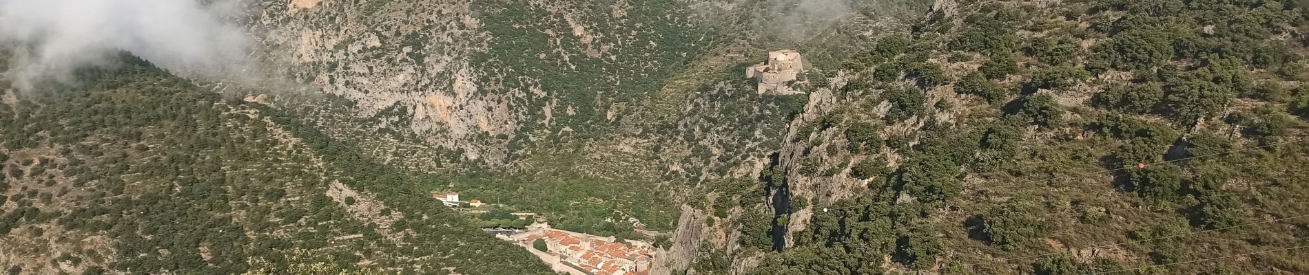
Fillols Sirach Taurinya

JeanPierreNancy
User
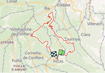

Length
20 km

Max alt
848 m

Uphill gradient
642 m
Km-Effort
29 km

Min alt
461 m

Downhill gradient
653 m
Boucle
Yes
Creation date :
2021-09-09 07:50:56.412
Updated on :
2021-09-09 09:47:07.162
1h55
Difficulty : Medium

FREE GPS app for hiking
 SityTrail
IGN / Geographical institutes
SityTrail Plus
The world is yours!
About
Trail Mountain bike of 20 km to be discovered at Occitania, Pyrénées-Orientales, Fillols. This trail is proposed by JeanPierreNancy.
Photos

Positioning
Country:
France
Region :
Occitania
Department/Province :
Pyrénées-Orientales
Municipality :
Fillols
Location:
Unknown
Start:(Dec)
Start:(UTM)
451561 ; 4712496 (31T) N.
Comments