


GLIERES: DECRASSAGE SUR LE PLATEAU

djeepee74
User

Length
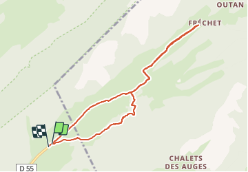
8.7 km

Max alt
1446 m

Uphill gradient
137 m
Km-Effort
10.6 km

Min alt
1365 m

Downhill gradient
141 m
Boucle
Yes
Creation date :
2021-09-18 12:42:26.45
Updated on :
2021-09-19 14:48:27.092
2h30
Difficulty : Very easy

FREE GPS app for hiking
 SityTrail
IGN / Geographical institutes
SityTrail Plus
The world is yours!
About
Trail Walking of 8.7 km to be discovered at Auvergne-Rhône-Alpes, Upper Savoy, Fillière. This trail is proposed by djeepee74.
Description
BOUCLE... live 20210918
Entre les Km 1.5 et 2.1, c'est souvent très "gras".
Positioning
Country:
France
Region :
Auvergne-Rhône-Alpes
Department/Province :
Upper Savoy
Municipality :
Fillière
Location:
Thorens-Glières
Start:(Dec)
Start:(UTM)
292843 ; 5093428 (32T) N.
Comments