


Cadières de Brandis version Light

donda
User GUIDE
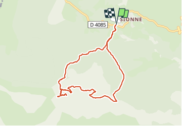

Length
9.2 km

Max alt
1555 m

Uphill gradient
460 m
Km-Effort
15.4 km

Min alt
1139 m

Downhill gradient
460 m
Boucle
Yes
Creation date :
2021-09-22 08:13:00.118
Updated on :
2021-09-23 14:54:31.497
3h00
Difficulty : Difficult

FREE GPS app for hiking
 SityTrail
IGN / Geographical institutes
SityTrail Plus
The world is yours!
About
Trail Walking of 9.2 km to be discovered at Provence-Alpes-Côte d'Azur, Alpes-de-Haute-Provence, Castellane. This trail is proposed by donda.
Description
Départ Parking col des Lèques, (Face au camping des Sirènes)
Route Napoléon D4085 direction Barrême.
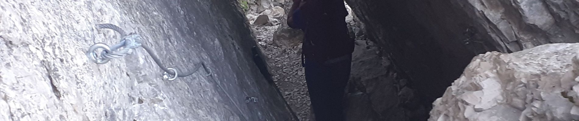
Photos


Positioning
Country:
France
Region :
Provence-Alpes-Côte d'Azur
Department/Province :
Alpes-de-Haute-Provence
Municipality :
Castellane
Location:
Unknown
Start:(Dec)
Start:(UTM)
296229 ; 4860083 (32T) N.
Comments