


gap

bougnaou
User
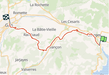

Length
29 km

Max alt
1124 m

Uphill gradient
710 m
Km-Effort
38 km

Min alt
725 m

Downhill gradient
810 m
Boucle
No
Creation date :
2021-10-01 06:22:20.792
Updated on :
2021-10-01 14:43:20.45
6h58
Difficulty : Difficult

FREE GPS app for hiking
 SityTrail
IGN / Geographical institutes
SityTrail Plus
The world is yours!
About
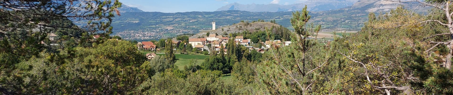
Trail Walking of 29 km to be discovered at Provence-Alpes-Côte d'Azur, Hautes-Alpes, Chorges. This trail is proposed by bougnaou.
Photos


Positioning
Country:
France
Region :
Provence-Alpes-Côte d'Azur
Department/Province :
Hautes-Alpes
Municipality :
Chorges
Location:
Unknown
Start:(Dec)
Start:(UTM)
284466 ; 4934071 (32T) N.
Comments