


charron

taguette
User
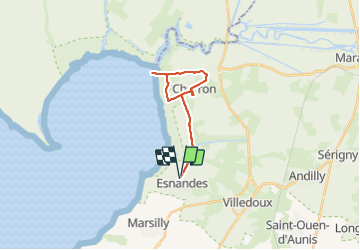

Length
18.1 km

Max alt
8 m

Uphill gradient
50 m
Km-Effort
18.8 km

Min alt
-1 m

Downhill gradient
49 m
Boucle
Yes
Creation date :
2021-10-07 08:35:00.27
Updated on :
2021-10-07 13:55:05.43
3h00
Difficulty : Difficult

FREE GPS app for hiking
 SityTrail
IGN / Geographical institutes
SityTrail Plus
The world is yours!
About
Trail Walking of 18.1 km to be discovered at New Aquitaine, Charente-Maritime, Esnandes. This trail is proposed by taguette.
Positioning
Country:
France
Region :
New Aquitaine
Department/Province :
Charente-Maritime
Municipality :
Esnandes
Location:
Unknown
Start:(Dec)
Start:(UTM)
645372 ; 5123858 (30T) N.
Comments