


thannenkirch ht-ribeaupierre

jcschubnel
User
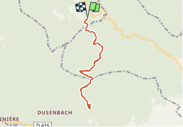

Length
7.7 km

Max alt
647 m

Uphill gradient
230 m
Km-Effort
10.8 km

Min alt
460 m

Downhill gradient
228 m
Boucle
Yes
Creation date :
2021-10-08 12:35:51.169
Updated on :
2021-10-08 16:41:05.182
2h45
Difficulty : Medium

FREE GPS app for hiking
 SityTrail
IGN / Geographical institutes
SityTrail Plus
The world is yours!
About
Trail Walking of 7.7 km to be discovered at Grand Est, Haut-Rhin, Thannenkirch. This trail is proposed by jcschubnel.
Positioning
Country:
France
Region :
Grand Est
Department/Province :
Haut-Rhin
Municipality :
Thannenkirch
Location:
Unknown
Start:(Dec)
Start:(UTM)
374090 ; 5342812 (32U) N.
Comments