


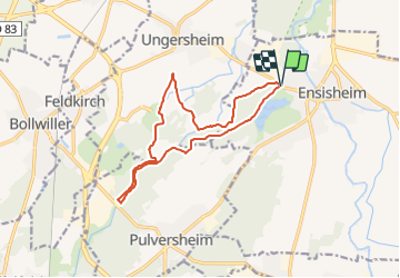
2021 10 Cross Ensisheim tour moyen

staubalex
User

Length
13.3 km

Max alt
235 m

Uphill gradient
88 m
Km-Effort
14.5 km

Min alt
212 m

Downhill gradient
87 m
Boucle
Yes
Creation date :
2021-10-09 06:09:54.668
Updated on :
2021-10-09 06:21:46.809
1h00
Difficulty : Easy

FREE GPS app for hiking
 SityTrail
IGN / Geographical institutes
SityTrail Plus
The world is yours!
About
Trail Mountain bike of 13.3 km to be discovered at Grand Est, Haut-Rhin, Ensisheim. This trail is proposed by staubalex.
Positioning
Country:
France
Region :
Grand Est
Department/Province :
Haut-Rhin
Municipality :
Ensisheim
Location:
Unknown
Start:(Dec)
Start:(UTM)
375641 ; 5302945 (32T) N.
Comments