


Aubazine- Puy de Pauliac-Canal

houbart
User
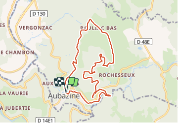

Length
10 km

Max alt
516 m

Uphill gradient
296 m
Km-Effort
13.9 km

Min alt
293 m

Downhill gradient
297 m
Boucle
Yes
Creation date :
2021-10-10 13:05:26.536
Updated on :
2021-10-12 06:41:33.864
3h06
Difficulty : Difficult

FREE GPS app for hiking
 SityTrail
IGN / Geographical institutes
SityTrail Plus
The world is yours!
About
Trail Walking of 10 km to be discovered at New Aquitaine, Corrèze, Aubazines. This trail is proposed by houbart.
Description
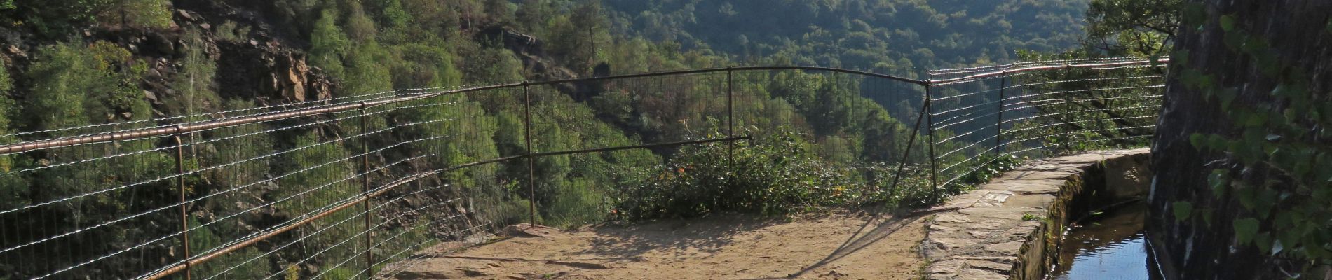
Rando très riche : abbaye, chapelle orthodoxe, ruines, dolmen, point de vue, canal des moines...
Photos


Positioning
Country:
France
Region :
New Aquitaine
Department/Province :
Corrèze
Municipality :
Aubazines
Location:
Unknown
Start:(Dec)
Start:(UTM)
395566 ; 5003257 (31T) N.
Comments