


Lapoutroie les mère elles

jcschubnel
User

Length
9.1 km

Max alt
844 m

Uphill gradient
423 m
Km-Effort
14.7 km

Min alt
421 m

Downhill gradient
421 m
Boucle
Yes
Creation date :
2021-10-14 11:53:26.827
Updated on :
2021-10-14 14:46:55.177
2h15
Difficulty : Difficult

FREE GPS app for hiking
 SityTrail
IGN / Geographical institutes
SityTrail Plus
The world is yours!
About
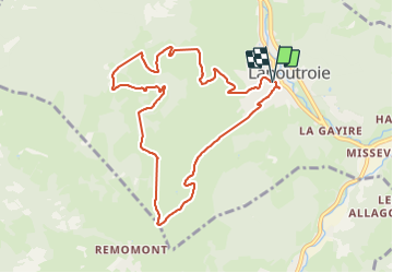
Trail Walking of 9.1 km to be discovered at Grand Est, Haut-Rhin, Lapoutroie. This trail is proposed by jcschubnel.
Positioning
Country:
France
Region :
Grand Est
Department/Province :
Haut-Rhin
Municipality :
Lapoutroie
Location:
Unknown
Start:(Dec)
Start:(UTM)
363721 ; 5334845 (32U) N.
Comments