


Pfaffenheim route

duchaine.nicolas
User
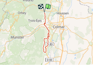

Length
40 km

Max alt
379 m

Uphill gradient
563 m
Km-Effort
47 km

Min alt
195 m

Downhill gradient
563 m
Boucle
Yes
Creation date :
2021-10-23 13:59:54.679
Updated on :
2021-10-23 19:18:05.503
2h17
Difficulty : Easy
2h17
Difficulty : Very easy

FREE GPS app for hiking
 SityTrail
IGN / Geographical institutes
SityTrail Plus
The world is yours!
About
Trail Road bike of 40 km to be discovered at Grand Est, Haut-Rhin, Ammerschwihr. This trail is proposed by duchaine.nicolas.
Positioning
Country:
France
Region :
Grand Est
Department/Province :
Haut-Rhin
Municipality :
Ammerschwihr
Location:
Unknown
Start:(Dec)
Start:(UTM)
372194 ; 5331995 (32U) N.
Comments