Trail Walking Theys - Grand Rocher - Photo
 flip38
flip38

User

© OpenStreetMap contributors
Length
Length
15.2 km
Max alt
Max alt
1925 m
Uphill gradient
Uphill gradient
657 m
Km-Effort
Km-Effort  
24 km
Min alt
Min alt
1496 m
Downhill gradient
Downhill gradient
646 m
Boucle
Boucle
Yes
Creation date :
2021-10-24 09:25:00.87
Updated on :
2021-10-31 10:40:35.224

(0 Reviews)

Walking
Walking
4h40
Difficulty : Medium

Scan this QR Code to open this trail in the SityTrail application

FREE GPS app for hiking

Logo SityTrail SityTrail

IGN / Geographical institutes

Download SityTrail from the App Store Download SityTrail from Google Play

Logo SityTrail SityTrail World

The world is yours!

Download SityTrail from the App Store Download SityTrail from Google Play Download SityTrail on Huawei AppGallery

About

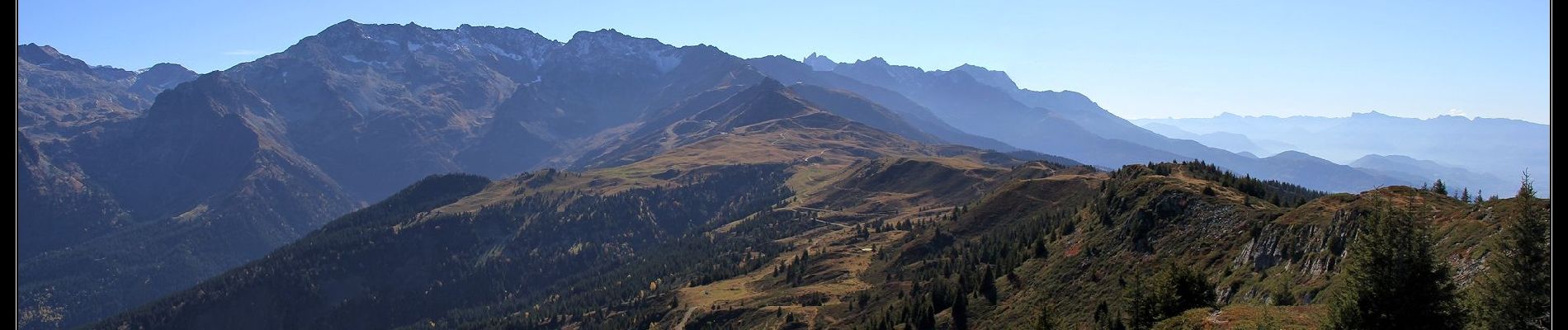
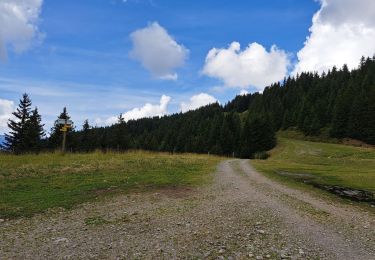
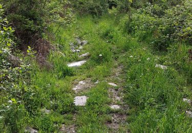
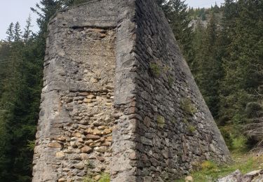
Trail Walking of 15.2 km to be discovered at Auvergne-Rhône-Alpes, Isère, Theys. This trail is proposed by flip38.

Description

Petite visite au Grand Rocher, souvent beaucoup de monde, mais le panorama est sympathique.
Boucle au départ de Pipay, les remontées mécaniques sont peut gênantes.

D'autres informations sur mon site : http://surlessommets.blog.free.fr/

Elevation profile

Photos

Positioning

Country:
France
Region :
Auvergne-Rhône-Alpes
Department/Province :
Isère
Municipality :
Theys
Location:
Unknown
Start:(UTM)
265846 ; 5016802 (32T) N.

Trails nearby

Trail Walking Les Adrets - les 7 laux - Photo
Walking
Didou2626

Walking

Medium
(1)
Les Adrets, Auvergne-Rhône-Alpes, Isère, France
12.4 km | 21 km-effort
4h 23min
Yes
Trail Walking Le Haut-Bréda - Combe du Prat - Photo
Walking
GUIDE
nadinebondoux

Walking

Medium
Le Haut-Bréda, Auvergne-Rhône-Alpes, Isère, France
9.5 km | 16.7 km-effort
3h 18min
Yes
Trail Mountain bike Theys - Autour du crêt de Chazay - Photo
Mountain bike
gilder89

Mountain bike

Medium
(1)
Theys, Auvergne-Rhône-Alpes, Isère, France
15.7 km | 23 km-effort
2h 30min
Yes
Trail Walking Le Haut-Bréda - Les lacs sept Claux - Photo
Walking
GUIDE
nadinebondoux

Walking

Difficult
Le Haut-Bréda, Auvergne-Rhône-Alpes, Isère, France
12.8 km | 27 km-effort
6h 56min
Yes
Trail Walking Le Haut-Bréda - cascade du Pissou - Photo
Walking
GUIDE
nadinebondoux

Walking

Medium
Le Haut-Bréda, Auvergne-Rhône-Alpes, Isère, France
5.9 km | 8.9 km-effort
2h 3min
Yes
Trail Other activity Le Haut-Bréda - Rocher Blanc 7 Laux - Photo
Other activity
loicthev

Other activity

Very difficult
(1)
Le Haut-Bréda, Auvergne-Rhône-Alpes, Isère, France
18.9 km | 44 km-effort
11h 2min
Yes
Trail Walking Theys - Col du Merdaret, Roche Noire au départ de Pipay  - Photo
Walking
Zasa

Walking

Easy
Theys, Auvergne-Rhône-Alpes, Isère, France
14.2 km | 24 km-effort
4h 15min
Yes
Trail Walking Theys - TOUR DE LA GRANGE DE BELLE AUX AIRS - Photo
Walking
walrou63

Walking

Medium
Theys, Auvergne-Rhône-Alpes, Isère, France
6.8 km | 10.1 km-effort
1h 40min
Yes
Trail Walking Laval-en-Belledonne - boucle lac de croq col de la mine de fer - Photo
Walking
tyax93

Walking

Medium
Laval-en-Belledonne, Auvergne-Rhône-Alpes, Isère, France
16.4 km | 35 km-effort
6h 40min
Yes


Close
My subscriptions