


École de Pollestres

Pascal Bernaud
User
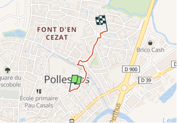

Length
735 m

Max alt
55 m

Uphill gradient
10 m
Km-Effort
835 m

Min alt
43 m

Downhill gradient
0 m
Boucle
No
Creation date :
2021-10-24 16:08:59.0
Updated on :
2021-10-24 16:22:35.261
13m
Difficulty : Easy

FREE GPS app for hiking
 SityTrail
IGN / Geographical institutes
SityTrail Plus
The world is yours!
About
Trail Walking of 735 m to be discovered at Occitania, Pyrénées-Orientales, Pollestres. This trail is proposed by Pascal Bernaud.
Positioning
Country:
France
Region :
Occitania
Department/Province :
Pyrénées-Orientales
Municipality :
Pollestres
Location:
Unknown
Start:(Dec)
Start:(UTM)
489440 ; 4720996 (31T) N.
Comments