


La Gautrie 26 octobre 2021

harydh
User GUIDE

Length
11 km

Max alt
12 m

Uphill gradient
34 m
Km-Effort
11.4 km

Min alt
-2 m

Downhill gradient
34 m
Boucle
Yes
Creation date :
2021-10-26 09:35:57.664
Updated on :
2021-10-26 14:12:36.977
4h35
Difficulty : Medium

FREE GPS app for hiking
 SityTrail
IGN / Geographical institutes
SityTrail Plus
The world is yours!
About
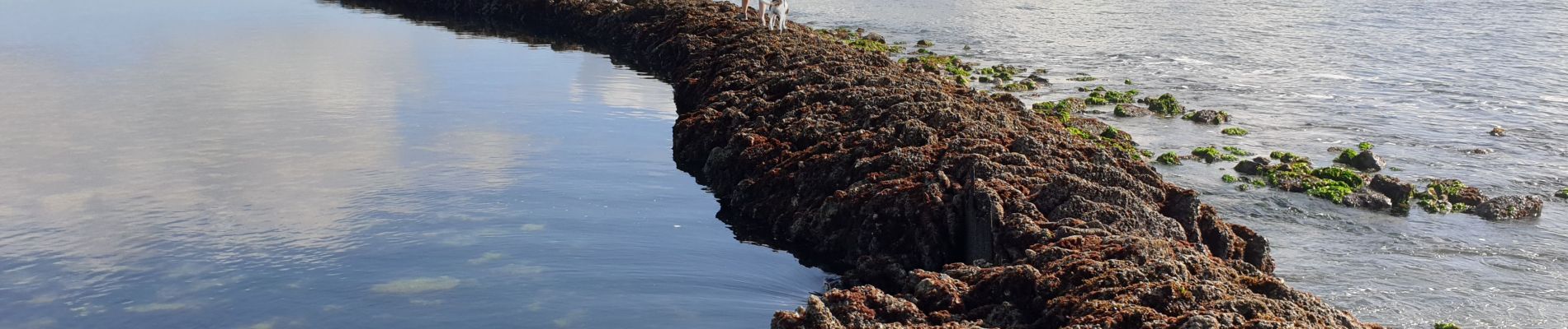
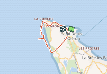
Trail Walking of 11 km to be discovered at New Aquitaine, Charente-Maritime, Saint-Denis-d'Oléron. This trail is proposed by harydh.
Photos


Positioning
Country:
France
Region :
New Aquitaine
Department/Province :
Charente-Maritime
Municipality :
Saint-Denis-d'Oléron
Location:
Unknown
Start:(Dec)
Start:(UTM)
625142 ; 5099088 (30T) N.
Comments