


Steinbach C de Turenne

ROPPJP
User

Length
13.4 km

Max alt
917 m

Uphill gradient
639 m
Km-Effort
22 km

Min alt
385 m

Downhill gradient
682 m
Boucle
No
Creation date :
2021-10-27 07:09:35.674
Updated on :
2021-10-27 12:34:03.434
5h23
Difficulty : Very difficult

FREE GPS app for hiking
 SityTrail
IGN / Geographical institutes
SityTrail Plus
The world is yours!
About
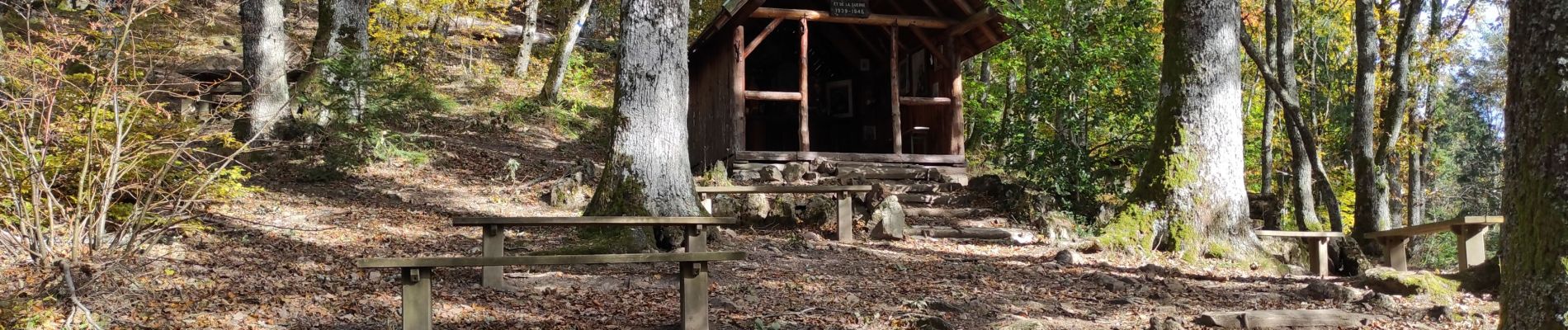
Trail Walking of 13.4 km to be discovered at Grand Est, Haut-Rhin, Steinbach. This trail is proposed by ROPPJP.
Description
pas tjs intéressant
Photos


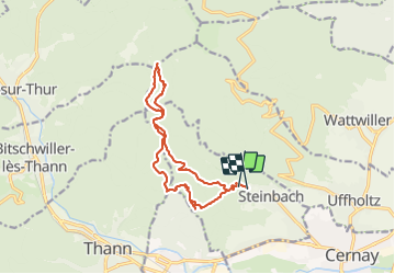
Positioning
Country:
France
Region :
Grand Est
Department/Province :
Haut-Rhin
Municipality :
Steinbach
Location:
Unknown
Start:(Dec)
Start:(UTM)
361025 ; 5298307 (32T) N.
Comments