


sickert

danif
User
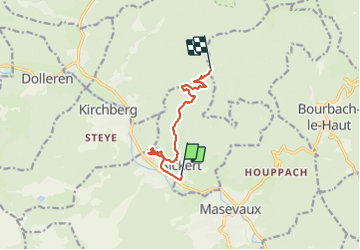

Length
7.8 km

Max alt
952 m

Uphill gradient
621 m
Km-Effort
14.4 km

Min alt
419 m

Downhill gradient
108 m
Boucle
No
Creation date :
2021-10-28 06:55:55.487
Updated on :
2021-10-28 15:29:53.874
7h07
Difficulty : Difficult

FREE GPS app for hiking
 SityTrail
IGN / Geographical institutes
SityTrail Plus
The world is yours!
About
Trail Walking of 7.8 km to be discovered at Grand Est, Haut-Rhin, Sickert. This trail is proposed by danif.
Positioning
Country:
France
Region :
Grand Est
Department/Province :
Haut-Rhin
Municipality :
Sickert
Location:
Unknown
Start:(Dec)
Start:(UTM)
348598 ; 5294128 (32T) N.
Comments