Trail Walking Bilhères - 2021-11-11_13h38m54_ST 2983217 G3 Pic d'Escurèts par le col Marie Blanque - Photo

2021-11-11_13h38m54_ST 2983217 G3 Pic d'Escurèts par le col Marie Blanque

© OpenStreetMap contributors
Length
Length
5.8 km
Max alt
Max alt
1423 m
Uphill gradient
Uphill gradient
393 m
Km-Effort
Km-Effort  
11 km
Min alt
Min alt
1035 m
Downhill gradient
Downhill gradient
393 m
Boucle
Boucle
Yes
Creation date :
2021-11-11 12:38:55.561
Updated on :
2021-11-17 16:23:03.742

(1 Reviews)

Walking
Walking
2h30
Difficulty : Medium

Scan this QR Code to open this trail in the SityTrail application

FREE GPS app for hiking

Logo SityTrail SityTrail

IGN / Geographical institutes

Download SityTrail from the App Store Download SityTrail from Google Play

Logo SityTrail SityTrail Plus

The world is yours!

Download SityTrail from the App Store Download SityTrail from Google Play Download SityTrail on Huawei AppGallery

About

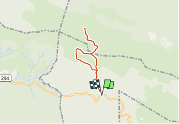
Trail Walking of 5.8 km to be discovered at New Aquitaine, Pyrénées-Atlantiques, Bilhères. This trail is proposed by mitch1952.

Description

A steady climb for the first kilometer, and it's necessary to take it easy in the begining until the muscles warm up.
Beautiful scenery with some fantastic views overlooking the plateau de Benou and Oloron Saint Marie.  It can get quite windy and cloudy once you reach the summit.
The climb down is quite steep and the path is stony so you need to be careful.
A short but sportive hike.

Elevation profile

Positioning

Country:
France
Region :
New Aquitaine
Department/Province :
Pyrénées-Atlantiques
Municipality :
Bilhères
Location:
Unknown
Start:(UTM)
702907 ; 4771640 (30T) N.

Comments

Please log in to post a review or rate the element


Close
My subscriptions