


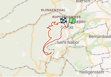


4.9 km | 6.3 km-effort

User


FREE GPS app for hiking
 SityTrail
IGN / Geographical institutes
SityTrail World
The world is yours!
Trail Walking of 12 km to be discovered at Grand Est, Bas-Rhin, Ottrott. This trail is proposed by Bart2015.
Le Mont St Odile, lieu sacré aux mille sentiers. On n'y va pas par hasard ... Toujours une belle rencontre avec soi-même et la beauté des lieux.
Passage par les châteaux d'Ottrott : Rathsamhausen et Lutzelbourg, en cours de réfection. Le site est aujourd'hui fermé.
Arrivée au Mont St Odile par le sentier des Merveilles et ses sculptures. Les enfants seront ravis.
Retour par le sentier des Pèlerins.
Bonne rando ...


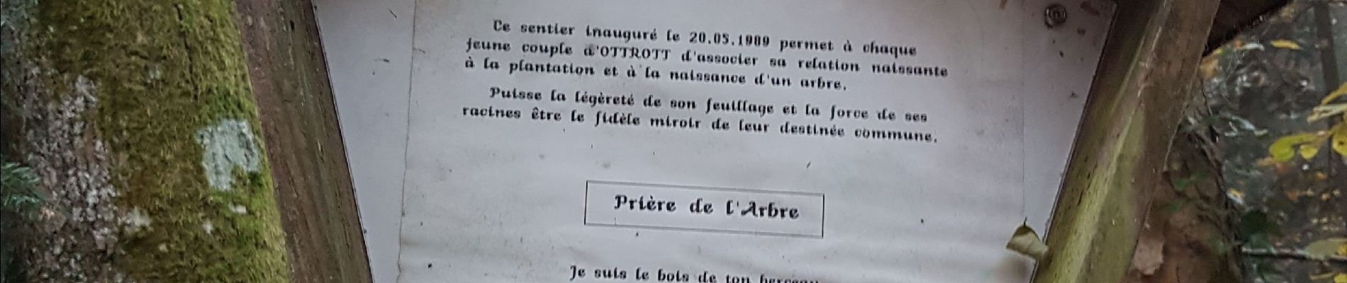
33 photos in total. Please click on a photo to see them all in the gallery.

Walking

Walking

Walking

Walking

Walking

Walking

Walking

Mountain bike

Mountain bike