Trail Walking Châtelus - 42-Chatelus-St-Christo-19km-590m-dec23 - Photo

42-Chatelus-St-Christo-19km-590m-dec23

 SyMA
SyMA

User

© OpenStreetMap contributors
Length
Length
18.7 km
Max alt
Max alt
904 m
Uphill gradient
Uphill gradient
587 m
Km-Effort
Km-Effort  
27 km
Min alt
Min alt
643 m
Downhill gradient
Downhill gradient
588 m
Boucle
Boucle
Yes
Creation date :
2021-11-11 08:13:25.36
Updated on :
2023-11-29 15:42:28.876

(0 Reviews)

Walking
Walking
6h01
Difficulty : Difficult

Scan this QR Code to open this trail in the SityTrail application

FREE GPS app for hiking

Logo SityTrail SityTrail

IGN / Geographical institutes

Download SityTrail from the App Store Download SityTrail from Google Play

Logo SityTrail SityTrail World

The world is yours!

Download SityTrail from the App Store Download SityTrail from Google Play Download SityTrail on Huawei AppGallery

About

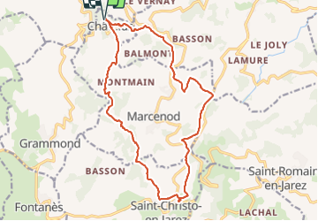
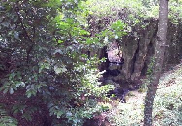
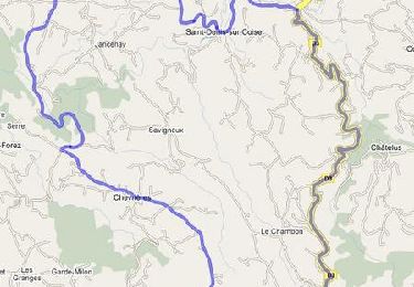
Trail Walking of 18.7 km to be discovered at Auvergne-Rhône-Alpes, Loire, Châtelus. This trail is proposed by SyMA.

Description

Départ Parking 14place de Chatelus
Restau : La méthanerie
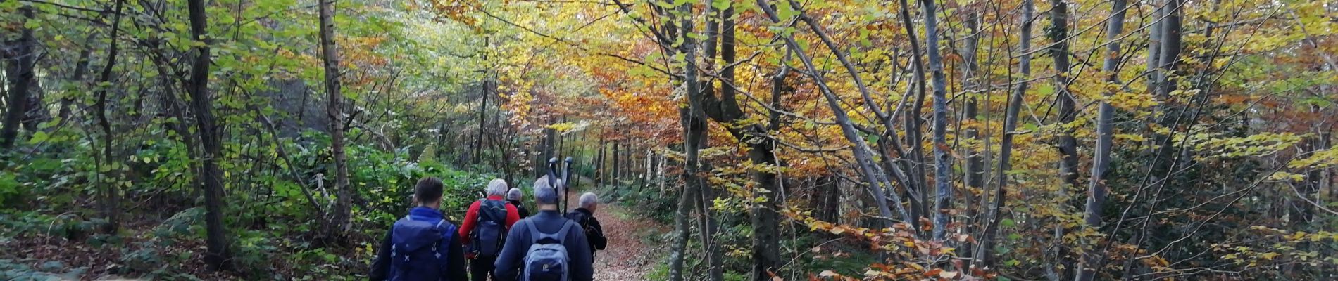
Elevation profile

Photos

Positioning

Country:
France
Region :
Auvergne-Rhône-Alpes
Department/Province :
Loire
Municipality :
Châtelus
Location:
Unknown
Start:(UTM)
614106 ; 5050440 (31T) N.

Trails nearby

Trail Walking Marcenod - Marcenod - Photo
Walking
psesjs

Walking

Very easy
Marcenod, Auvergne-Rhône-Alpes, Loire, France
20 km | 29 km-effort
4h 50min
Yes
Trail Mountain bike Saint-Symphorien-sur-Coise - La 4ème Pelaude (2013-VTT-45km) - Saint-Symphorien sur Coise - Photo
Mountain bike
tracegps

Mountain bike

Very difficult
Saint-Symphorien-sur-Coise, Auvergne-Rhône-Alpes, Rhône, France
45 km | 62 km-effort
5h 0min
Yes
Trail Walking Larajasse - larajasse  - Photo
Walking
bpc

Walking

Medium
Larajasse, Auvergne-Rhône-Alpes, Rhône, France
19.4 km | 28 km-effort
5h 18min
Yes
Trail Cycle Chazelles-sur-Lyon - Montée Grammond  départ Chazelles sur Lyon - Photo
Cycle
tracegps

Cycle

Medium
Chazelles-sur-Lyon, Auvergne-Rhône-Alpes, Loire, France
33 km | 41 km-effort
1h 30min
Yes
Trail Walking La Gimond - La Gimond - 16km - Photo
Walking
Les Randos de Didier

Walking

Very difficult
La Gimond, Auvergne-Rhône-Alpes, Loire, France
16.5 km | 24 km-effort
5h 21min
Yes
Trail On foot Larajasse - Les trois villages - Photo
On foot
grange69

On foot

Difficult
Larajasse, Auvergne-Rhône-Alpes, Rhône, France
21 km | 31 km-effort
7h 8min
Yes
Trail Horseback riding Marcenod - saint christo - Photo
Horseback riding
AnneMarie Michel

Horseback riding

Easy
Marcenod, Auvergne-Rhône-Alpes, Loire, France
7.5 km | 9.7 km-effort
1h 53min
No
Trail Walking Larajasse - Larajasse pompiers  - Photo
Walking
mmmo

Walking

Medium
Larajasse, Auvergne-Rhône-Alpes, Rhône, France
18.1 km | 27 km-effort
5h 2min
Yes
Trail Walking Larajasse - Larajasse - Les trois clochers - Rhone - Photo
Walking
ThierryJ01

Walking

Very difficult
Larajasse, Auvergne-Rhône-Alpes, Rhône, France
15.3 km | 23 km-effort
5h 11min
Yes


Close
My subscriptions