Trail Walking Roquefère - St Julien - Photo
 Mascart
Mascart

User

© OpenStreetMap contributors
Length
Length
6.4 km
Max alt
Max alt
575 m
Uphill gradient
Uphill gradient
315 m
Km-Effort
Km-Effort  
10.5 km
Min alt
Min alt
317 m
Downhill gradient
Downhill gradient
297 m
Boucle
Boucle
No
Creation date :
2021-11-16 12:43:03.384
Updated on :
2021-11-16 16:59:13.984

(0 Reviews)

Walking
Walking
3h04
Difficulty : Medium

Scan this QR Code to open this trail in the SityTrail application

FREE GPS app for hiking

Logo SityTrail SityTrail

IGN / Geographical institutes

Download SityTrail from the App Store Download SityTrail from Google Play

Logo SityTrail SityTrail World

The world is yours!

Download SityTrail from the App Store Download SityTrail from Google Play Download SityTrail on Huawei AppGallery

About

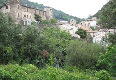
Trail Walking of 6.4 km to be discovered at Occitania, Aude, Roquefère. This trail is proposed by Mascart.

Description

départ Roquefere retour de là bastide Esparberainque par la rivière

Elevation profile

Positioning

Country:
France
Region :
Occitania
Department/Province :
Aude
Municipality :
Roquefère
Location:
Unknown
Start:(UTM)
449582 ; 4802242 (31T) N.

Trails nearby

Trail Walking Roquefère - La cascade de Cubserviès - Roquefère - Photo
Walking
tracegps

Walking

Difficult
(3)
Roquefère, Occitania, Aude, France
16.1 km | 25 km-effort
8h 16min
Yes
Trail Walking La Tourette-Cabardès - Rndonnée autour de la Tourette Cabardès - Photo
Walking
tracegps

Walking

Medium
(1)
La Tourette-Cabardès, Occitania, Aude, France
12 km | 17.2 km-effort
3h 19min
Yes
Trail Walking Miraval-Cabardès - Miraval - Lacoste - Roc du Bougre - Photo
Walking
mikaou.t

Walking

Difficult
(1)
Miraval-Cabardès, Occitania, Aude, France
11.4 km | 18.1 km-effort
3h 45min
Yes
Trail On foot Labastide-Esparbairenque - Les Villages Perchés - Photo
On foot
PRO

On foot

Difficult
Labastide-Esparbairenque, Occitania, Aude, France
24 km | 38 km-effort
8h 32min
Yes
Trail Walking Les Ilhes - Les Ilhes - Photo
Walking
GUIDE
Ada11

Walking

Easy
Les Ilhes, Occitania, Aude, France
17.3 km | 26 km-effort
4h 56min
Yes
Trail On foot Roquefère - Labastide-Espabïrenque, Prat Viel, Picarot haut - Photo
On foot
mikaou.t

On foot

Medium
(1)
Roquefère, Occitania, Aude, France
10.2 km | 15.6 km-effort
3h 0min
Yes
Trail Walking Les Ilhes - les Trois Vallées - Photo
Walking
Pierre11

Walking

Medium
(2)
Les Ilhes, Occitania, Aude, France
13.8 km | 22 km-effort
4h 41min
Yes
Trail Walking Lastours - Lastours dans l'Aude et ses tours... - Photo
Walking
tracegps

Walking

Easy
(1)
Lastours, Occitania, Aude, France
2.8 km | 4.2 km-effort
2h 0min
Yes
Trail Walking Limousis - Limousis  - Photo
Walking
Christophe Ferreres

Walking

Difficult
Limousis, Occitania, Aude, France
9.8 km | 14.9 km-effort
3h 48min
Yes


Close
My subscriptions