Trail Walking Unknown - Lac de Siscaro waypoints land - Photo

Lac de Siscaro waypoints land

 Nordic33
Nordic33

User GUIDE

© OpenStreetMap contributors
Length
Length
11 km
Max alt
Max alt
2574 m
Uphill gradient
Uphill gradient
772 m
Km-Effort
Km-Effort  
21 km
Min alt
Min alt
1833 m
Downhill gradient
Downhill gradient
767 m
Boucle
Boucle
Yes
Creation date :
2021-11-19 10:21:03.047
Updated on :
2022-06-10 10:58:33.464

(2 Reviews)

Walking
Walking
4h51
Difficulty : Difficult

Scan this QR Code to open this trail in the SityTrail application

FREE GPS app for hiking

Logo SityTrail SityTrail

IGN / Geographical institutes

Download SityTrail from the App Store Download SityTrail from Google Play

Logo SityTrail SityTrail World

The world is yours!

Download SityTrail from the App Store Download SityTrail from Google Play Download SityTrail on Huawei AppGallery

About

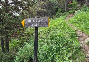
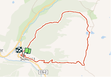
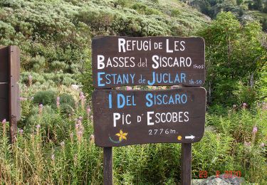
Trail Walking of 11 km to be discovered at Andorra. This trail is proposed by Nordic33.

Description

Juin 2015
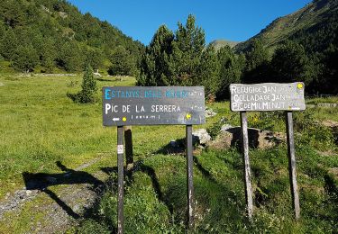
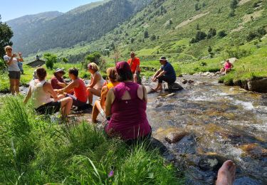
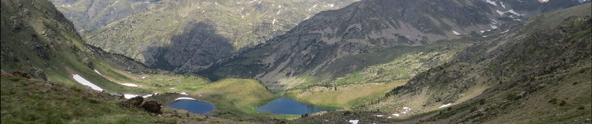
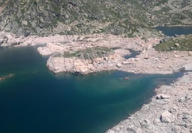
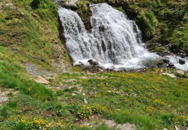
Le lac de Baix, connu sous le nom de lac del Siscaró, d’une superficie d’un hectare,se trouve à 2.325 mètres d’altitude, dans la vallée d’Incles, vallée qui s’ancre dans un relief marqué par l’activité des glaciers de l’ère quaternaire.
Ce lac présente une particularité : les tiges de l’espèce de soude aux fleurs rosées qui y pousse, la Salsola vermiculata, le “siscall” en catalan, donne un ton différent au bleu de l’eau, et son nom au lac qu’on appelle communément Siscaró.


Elevation profile

Photos

Positioning

Country:
Andorra
Region :
Unknown
Department/Province :
Unknown
Municipality :
Unknown
Location:
Unknown
Start:(UTM)
390542 ; 4714736 (31T) N.

Comments

Please log in to post a review or rate the element


Trails nearby

Trail Walking  - 2010_08_27_RANSOL - Photo
Walking
GUIDE
Nordic33

Walking

Medium
(2)
, , , Andorra
3.9 km | 7.5 km-effort
1h 42min
Yes
Trail Walking  - estany de jugla - Photo
Walking
F_Fred

Walking

Very easy
(1)
, , , Andorra
6.8 km | 12.8 km-effort
2h 6min
No
Trail Walking  - jan - Photo
Walking
GUIDE
Nordic33

Walking

Medium
, , , Andorra
4.1 km | 7.8 km-effort
2h 59min
Yes
Trail Walking  - andorre_Juclar_20100823 - Photo
Walking
GUIDE
Nordic33

Walking

Difficult
, , , Andorra
11.9 km | 21 km-effort
4h 45min
Yes
Trail Walking  - 11133234-chemin du coq_jul-2017_openrunner - Photo
Walking
GUIDE
Nordic33

Walking

Medium
, , , Andorra
6 km | 8.6 km-effort
1h 57min
No
Trail Walking  - pic de serrera_07-2017 - Photo
Walking
GUIDE
Nordic33

Walking

Very difficult
, , , Andorra
8.9 km | 22 km-effort
4h 55min
Yes
Trail Walking  - siscaro 18_06  - Photo
Walking
GUIDE
Nordic33

Walking

Very difficult
, , , Andorra
13.8 km | 23 km-effort
10h 30min
Yes
Trail Walking  - incles - Photo
Walking
GUIDE
Nordic33

Walking

Difficult
, , , Andorra
12.5 km | 18.8 km-effort
5h 58min
No
Trail Walking  - Reco-siscaro-2022-05-27-ajusté - Photo
Walking
GUIDE
Nordic33

Walking

Difficult
, , , Andorra
10.7 km | 21 km-effort
5h 0min
Yes


Close
My subscriptions