


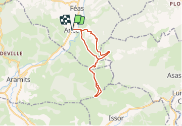
Ance Unars G3 2021

LouisROGER
User GUIDE

Length
13.3 km

Max alt
593 m

Uphill gradient
523 m
Km-Effort
20 km

Min alt
243 m

Downhill gradient
523 m
Boucle
Yes
Creation date :
2021-11-26 08:37:17.451
Updated on :
2021-11-26 14:35:05.237
3h50
Difficulty : Very difficult

FREE GPS app for hiking
 SityTrail
IGN / Geographical institutes
SityTrail Plus
The world is yours!
About
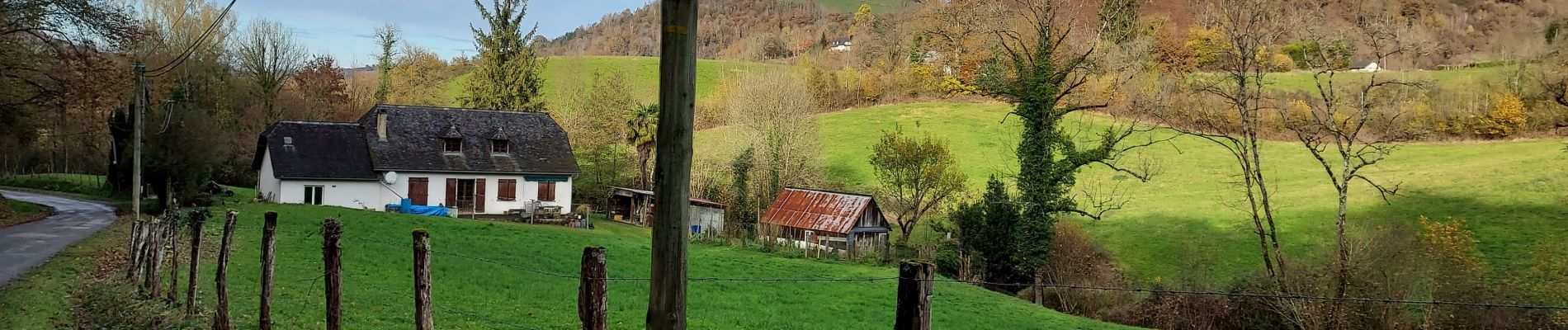
Trail Walking of 13.3 km to be discovered at New Aquitaine, Pyrénées-Atlantiques, Ance-Féas. This trail is proposed by LouisROGER.
Photos


Positioning
Country:
France
Region :
New Aquitaine
Department/Province :
Pyrénées-Atlantiques
Municipality :
Ance-Féas
Location:
Ance
Start:(Dec)
Start:(UTM)
687734 ; 4779456 (30T) N.
Comments