


D40 - GR 10

loic09
User

Length
20 km

Max alt
2076 m

Uphill gradient
1419 m
Km-Effort
38 km

Min alt
934 m

Downhill gradient
938 m
Boucle
No
Creation date :
2014-12-10 00:00:00.0
Updated on :
2014-12-10 00:00:00.0
8h01
Difficulty : Medium

FREE GPS app for hiking
 SityTrail
IGN / Geographical institutes
SityTrail Plus
The world is yours!
About
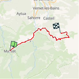
Trail Walking of 20 km to be discovered at Occitania, Pyrénées-Orientales, Mantet. This trail is proposed by loic09.
Description
Mantet/Col de Segales

Positioning
Country:
France
Region :
Occitania
Department/Province :
Pyrénées-Orientales
Municipality :
Mantet
Location:
Unknown
Start:(Dec)
Start:(UTM)
443013 ; 4703025 (31T) N.
Comments