Trail Walking Château-Arnoux-Saint-Auban - CHATEAU ARNOUX.  S Jean , chemin des Bruyères,  les Grandes Côtes o l s - Photo

CHATEAU ARNOUX. S Jean , chemin des Bruyères, les Grandes Côtes o l s

© OpenStreetMap contributors
Length
Length
14.5 km
Max alt
Max alt
740 m
Uphill gradient
Uphill gradient
498 m
Km-Effort
Km-Effort  
21 km
Min alt
Min alt
480 m
Downhill gradient
Downhill gradient
497 m
Boucle
Boucle
Yes
Creation date :
2021-12-09 06:37:37.169
Updated on :
2021-12-09 19:40:42.68

(1 Reviews)

Walking
Walking
4h46
Difficulty : Medium

Scan this QR Code to open this trail in the SityTrail application

FREE GPS app for hiking

Logo SityTrail SityTrail

IGN / Geographical institutes

Download SityTrail from the App Store Download SityTrail from Google Play

Logo SityTrail SityTrail World

The world is yours!

Download SityTrail from the App Store Download SityTrail from Google Play Download SityTrail on Huawei AppGallery

About

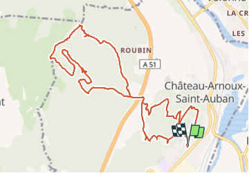
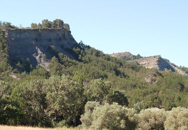
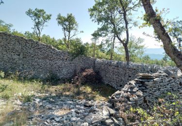
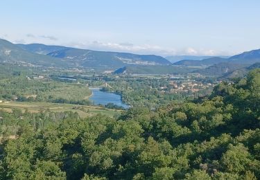
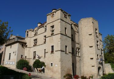
Trail Walking of 14.5 km to be discovered at Provence-Alpes-Côte d'Azur, Alpes-de-Haute-Provence, Château-Arnoux-Saint-Auban. This trail is proposed by RobinMicheline.

Elevation profile

Photos

Positioning

Country:
France
Region :
Provence-Alpes-Côte d'Azur
Department/Province :
Alpes-de-Haute-Provence
Municipality :
Château-Arnoux-Saint-Auban
Location:
Unknown
Start:(UTM)
260111 ; 4885544 (32T) N.

Comments

Please log in to post a review or rate the element


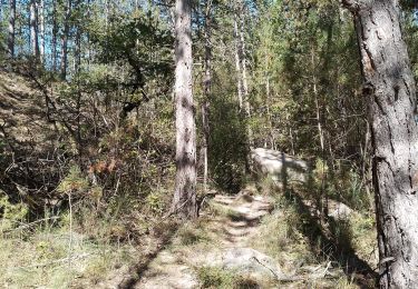
belle randonnée. belle vue sur vallée , sentier dans bruyères sympa


Trails nearby

Trail Walking Châteauneuf-Val-Saint-Donat - Bergeries en pierres sèches - Châteauneuf Val Saint Donat - Photo
Walking
tracegps

Walking

Medium
(2)
Châteauneuf-Val-Saint-Donat, Provence-Alpes-Côte d'Azur, Alpes-de-Haute-Provence, France
7.6 km | 11.2 km-effort
2h 19min
Yes
Trail Running Volonne - les 2 sommets sr Jean et tigne - Photo
Running
Bruno.r

Running

Medium
(1)
Volonne, Provence-Alpes-Côte d'Azur, Alpes-de-Haute-Provence, France
10.4 km | 16.2 km-effort
1h 7min
Yes
Trail Walking L'Escale - Les Balcons de la Durance 11.2.24 - Photo
Walking
fredetpascale

Walking

Medium
L'Escale, Provence-Alpes-Côte d'Azur, Alpes-de-Haute-Provence, France
14.6 km | 21 km-effort
4h 30min
Yes
Trail Walking Volonne - Tour du lac de Volonne - Photo
Walking
babouille

Walking

Medium
Volonne, Provence-Alpes-Côte d'Azur, Alpes-de-Haute-Provence, France
7.5 km | 8.4 km-effort
1h 54min
Yes
Trail Walking Aubignosc - aubignosc. les canyons. partie basse - Photo
Walking
Roger

Walking

Medium
Aubignosc, Provence-Alpes-Côte d'Azur, Alpes-de-Haute-Provence, France
7.9 km | 11.1 km-effort
2h 50min
Yes
Trail Walking Aubignosc - aubignosc. Le canyon de mourieu  , partie haute  - Photo
Walking
Roger

Walking

Medium
Aubignosc, Provence-Alpes-Côte d'Azur, Alpes-de-Haute-Provence, France
4.9 km | 6.7 km-effort
2h 20min
Yes
Trail Walking Châteauneuf-Val-Saint-Donat - château neuf, val St donat - Photo
Walking
Roger

Walking

Medium
Châteauneuf-Val-Saint-Donat, Provence-Alpes-Côte d'Azur, Alpes-de-Haute-Provence, France
6.8 km | 10 km-effort
2h 40min
Yes
Trail Walking L'Escale - L ESCALE . LES BALCONS DE LA DURANCE . O - Photo
Walking
RobinMicheline

Walking

Medium
L'Escale, Provence-Alpes-Côte d'Azur, Alpes-de-Haute-Provence, France
14.9 km | 21 km-effort
4h 33min
Yes
Trail On foot Volonne - Tour du Lac - Photo
On foot
PRO

On foot

Easy
Volonne, Provence-Alpes-Côte d'Azur, Alpes-de-Haute-Provence, France
4.6 km | 5.2 km-effort
1h 11min
No


Close
My subscriptions