


St hippolyte ht koenigsbourg

legereric
User
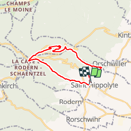

Length
12 km

Max alt
738 m

Uphill gradient
505 m
Km-Effort
18.7 km

Min alt
249 m

Downhill gradient
507 m
Boucle
Yes
Creation date :
2014-12-10 00:00:00.0
Updated on :
2014-12-10 00:00:00.0
3h27
Difficulty : Medium

FREE GPS app for hiking
 SityTrail
IGN / Geographical institutes
SityTrail Plus
The world is yours!
About
Trail Walking of 12 km to be discovered at Grand Est, Haut-Rhin, Saint-Hippolyte. This trail is proposed by legereric.
Description
2914-05-18 rando cops Marcko
Positioning
Country:
France
Region :
Grand Est
Department/Province :
Haut-Rhin
Municipality :
Saint-Hippolyte
Location:
Unknown
Start:(Dec)
Start:(UTM)
378672 ; 5343482 (32U) N.
Comments
À faire par de fortes chaleurs Principales en forêt