Trail Walking Oô - D22 - GR 10 VAR - Photo

D22 - GR 10 VAR

 loic09
loic09

User

© OpenStreetMap contributors
Length
Length
16.5 km
Max alt
Max alt
2272 m
Uphill gradient
Uphill gradient
585 m
Km-Effort
Km-Effort  
28 km
Min alt
Min alt
707 m
Downhill gradient
Downhill gradient
1779 m
Boucle
Boucle
No
Creation date :
2014-12-10 00:00:00.0
Updated on :
2014-12-10 00:00:00.0

(0 Reviews)

Walking
Walking
5h06
Difficulty : Medium

Scan this QR Code to open this trail in the SityTrail application

FREE GPS app for hiking

Logo SityTrail SityTrail

IGN / Geographical institutes

Download SityTrail from the App Store Download SityTrail from Google Play

Logo SityTrail SityTrail World

The world is yours!

Download SityTrail from the App Store Download SityTrail from Google Play Download SityTrail on Huawei AppGallery

About

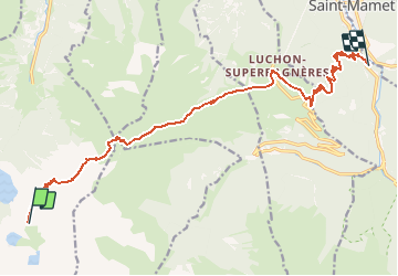
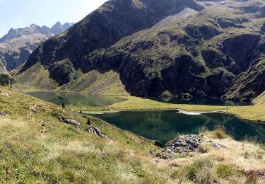
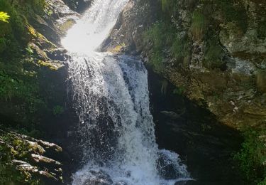
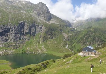
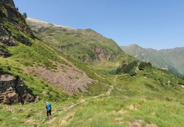
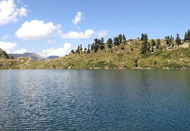
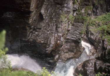
Trail Walking of 16.5 km to be discovered at Occitania, Haute-Garonne, Oô. This trail is proposed by loic09.

Description

Gros rocher/Bagnères de Luchon

Elevation profile

Points of interest

Point of interest Bagnères-de-Luchon -  - Photo
loic09
BAGNÈRES-DE-LUCHON 

Positioning

Country:
France
Region :
Occitania
Department/Province :
Haute-Garonne
Municipality :
Location:
Unknown
Start:(Dec)
Start:(UTM)
295392 ; 4734101 (31T) N.

Trails nearby

Trail Walking Oô - Pic des Spijeoles - Photo
Walking
tracegps

Walking

Very difficult
(1)
Oô, Occitania, Haute-Garonne, France
17.4 km | 37 km-effort
14h 0min
No
Trail On foot Castillon-de-Larboust - Lac Vert, Boucle par l'Est - Photo
On foot
PRO

On foot

Easy
Castillon-de-Larboust, Occitania, Haute-Garonne, France
8.8 km | 19.5 km-effort
4h 26min
No
Trail Walking Oô - Seil de la Baque - Photo
Walking
ach31

Walking

Difficult
(1)
Oô, Occitania, Haute-Garonne, France
28 km | 56 km-effort
11h 9min
Yes
Trail Walking Castillon-de-Larboust - Cabane de la Coume - Photo
Walking
swp648

Walking

Difficult
Castillon-de-Larboust, Occitania, Haute-Garonne, France
9.1 km | 18.4 km-effort
3h 39min
Yes
Trail Walking Oô - Refuge d'Espingo par le lac d'Oô - Photo
Walking
swp648

Walking

Difficult
Oô, Occitania, Haute-Garonne, France
6.2 km | 14.6 km-effort
2h 37min
No
Trail Walking Castillon-de-Larboust - lacs vert et bleu en boucle - Photo
Walking
chrisgps

Walking

Difficult
Castillon-de-Larboust, Occitania, Haute-Garonne, France
15.2 km | 32 km-effort
9h 17min
Yes
Trail On foot Castillon-de-Larboust - Grand circuit des lacs via le refuge du Maupas - Photo
On foot
PRO

On foot

Medium
Castillon-de-Larboust, Occitania, Haute-Garonne, France
8 km | 20 km-effort
4h 38min
No
Trail On foot Oô - Lac d'Oô et refuge d'Espingo - Photo
On foot
PRO

On foot

Easy
Oô, Occitania, Haute-Garonne, France
5.9 km | 14.4 km-effort
3h 16min
No
Trail On foot Castillon-de-Larboust - Le cirque des Crabioules - Photo
On foot
PRO

On foot

Easy
Castillon-de-Larboust, Occitania, Haute-Garonne, France
8.2 km | 15.2 km-effort
3h 26min
No


Close
My subscriptions