


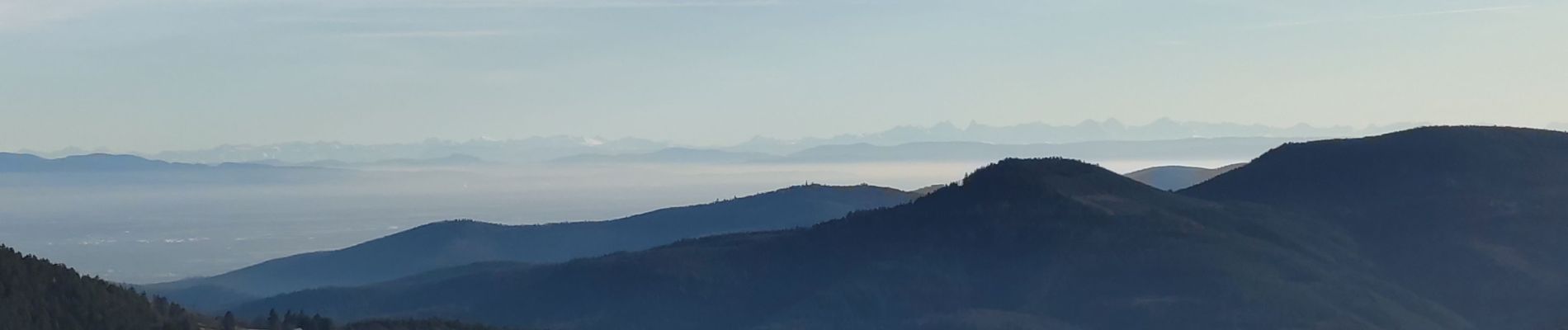
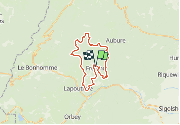
tour de Fréland

duchaine.nicolas
User

Length
24 km

Max alt
949 m

Uphill gradient
792 m
Km-Effort
35 km

Min alt
424 m

Downhill gradient
796 m
Boucle
Yes
Creation date :
2022-01-01 12:56:01.562
Updated on :
2022-01-01 15:18:57.488
2h22
Difficulty : Easy
2h21
Difficulty : Easy

FREE GPS app for hiking
 SityTrail
IGN / Geographical institutes
SityTrail Plus
The world is yours!
About
Trail Mountain bike of 24 km to be discovered at Grand Est, Haut-Rhin, Fréland. This trail is proposed by duchaine.nicolas.
Photos


Positioning
Country:
France
Region :
Grand Est
Department/Province :
Haut-Rhin
Municipality :
Fréland
Location:
Unknown
Start:(Dec)
Start:(UTM)
365795 ; 5337172 (32U) N.
Comments