Trail Walking Roquebrune-Cap-Martin - Roquebrune-Menton 01 2022 - Photo
 coriace
coriace

User

© OpenStreetMap contributors
Length
Length
9.5 km
Max alt
Max alt
44 m
Uphill gradient
Uphill gradient
144 m
Km-Effort
Km-Effort  
11.5 km
Min alt
Min alt
0 m
Downhill gradient
Downhill gradient
153 m
Boucle
Boucle
No
Creation date :
2022-01-01 12:08:21.965
Updated on :
2022-01-02 13:45:12.586

(0 Reviews)

Walking
Walking
2h14
Difficulty : Very easy

Scan this QR Code to open this trail in the SityTrail application

FREE GPS app for hiking

Logo SityTrail SityTrail

IGN / Geographical institutes

Download SityTrail from the App Store Download SityTrail from Google Play

Logo SityTrail SityTrail World

The world is yours!

Download SityTrail from the App Store Download SityTrail from Google Play Download SityTrail on Huawei AppGallery

About

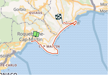
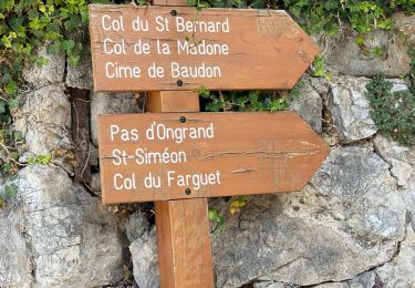
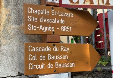
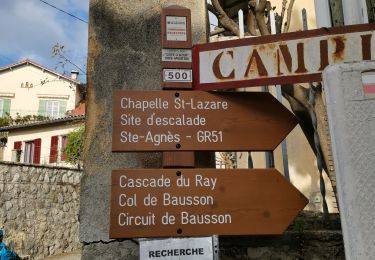
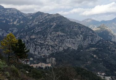
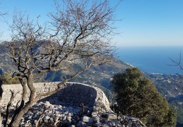
Trail Walking of 9.5 km to be discovered at Provence-Alpes-Côte d'Azur, Maritime Alps, Roquebrune-Cap-Martin. This trail is proposed by coriace.

Description

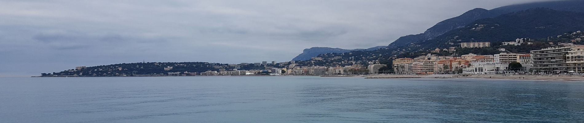
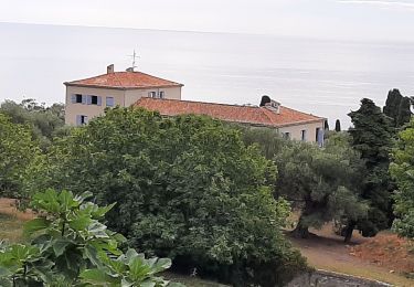
Départ gare de Roquebrune et arrivée à Menton par le chemin des douaniers .

Elevation profile

Photos

Positioning

Country:
France
Region :
Provence-Alpes-Côte d'Azur
Department/Province :
Maritime Alps
Municipality :
Roquebrune-Cap-Martin
Location:
Unknown
Start:(UTM)
375855 ; 4846426 (32T) N.

Trails nearby

Trail On foot Peille - Cime de Baudon - Photo
On foot
PRO

On foot

Easy
Peille, Provence-Alpes-Côte d'Azur, Maritime Alps, France
7 km | 14.7 km-effort
3h 20min
Yes
Trail Walking Roquebrune-Cap-Martin - cape martin - Photo
Walking
danpar

Walking

Medium
(2)
Roquebrune-Cap-Martin, Provence-Alpes-Côte d'Azur, Maritime Alps, France
4.4 km | 5.9 km-effort
1h 57min
Yes
Trail Other activity La Turbie - fort de la Revere  - Photo
Other activity
juleyann

Other activity

Very easy
(1)
La Turbie, Provence-Alpes-Côte d'Azur, Maritime Alps, France
8.4 km | 12 km-effort
1h 37min
Yes
Trail Walking Menton - tour du Cap Roquebrune Cap Martin - Photo
Walking
piahi

Walking

Difficult
Menton, Provence-Alpes-Côte d'Azur, Maritime Alps, France
10.6 km | 16 km-effort
3h 1min
Yes
Trail Walking Peille - Peille : Cime du Baudon et Mont Ours - Photo
Walking
ETMU5496

Walking

Very difficult
Peille, Provence-Alpes-Côte d'Azur, Maritime Alps, France
19.9 km | 38 km-effort
5h 46min
Yes
Trail Walking Gorbio - Gorbio Ste-Agnès - Cime de Baudon - Photo
Walking
ETMU5496

Walking

Difficult
Gorbio, Provence-Alpes-Côte d'Azur, Maritime Alps, France
18.3 km | 35 km-effort
5h 10min
Yes
Trail Walking Gorbio - Village de Gorbio - Ste Agnes puis les Cretes  - Photo
Walking
clarambre

Walking

Difficult
Gorbio, Provence-Alpes-Côte d'Azur, Maritime Alps, France
17.1 km | 34 km-effort
7h 0min
Yes
Trail Walking Gorbio - Circuit des Cabanelles - Photo
Walking
domi06

Walking

Medium
Gorbio, Provence-Alpes-Côte d'Azur, Maritime Alps, France
10.2 km | 20 km-effort
5h 9min
Yes
Trail Walking Sainte-Agnès - Sainte-Agnès (Pointe de Siricocca, Pic de Garuche et Mont Ours) - Photo
Walking
AntoineBM

Walking

Medium
Sainte-Agnès, Provence-Alpes-Côte d'Azur, Maritime Alps, France
14.4 km | 26 km-effort
3h 36min
No


Close
My subscriptions