


céret 1

Phidel66
User

Length
115 km

Max alt
305 m

Uphill gradient
1062 m
Km-Effort
129 km

Min alt
5 m

Downhill gradient
943 m
Boucle
No
Creation date :
2021-12-14 18:57:40.036
Updated on :
2022-01-07 10:23:59.646
37h06
Difficulty : Very difficult

FREE GPS app for hiking
 SityTrail
IGN / Geographical institutes
SityTrail Plus
The world is yours!
About
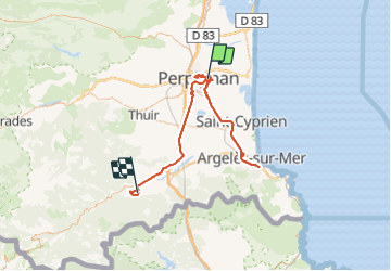
Trail Walking of 115 km to be discovered at Occitania, Pyrénées-Orientales, Perpignan. This trail is proposed by Phidel66.
Description
Romarins
Positioning
Country:
France
Region :
Occitania
Department/Province :
Pyrénées-Orientales
Municipality :
Perpignan
Location:
Unknown
Start:(Dec)
Start:(UTM)
493589 ; 4727171 (31T) N.
Comments