


Kientzheim

jcschubnel
User
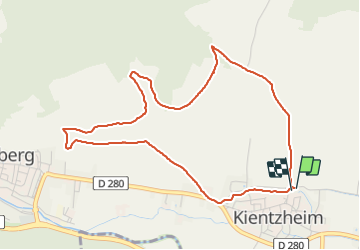

Length
4.8 km

Max alt
353 m

Uphill gradient
136 m
Km-Effort
6.6 km

Min alt
222 m

Downhill gradient
135 m
Boucle
Yes
Creation date :
2022-01-08 13:27:41.806
Updated on :
2022-01-08 15:45:00.611
1h19
Difficulty : Medium

FREE GPS app for hiking
 SityTrail
IGN / Geographical institutes
SityTrail Plus
The world is yours!
About
Trail Walking of 4.8 km to be discovered at Grand Est, Haut-Rhin, Kaysersberg-Vignoble. This trail is proposed by jcschubnel.
Positioning
Country:
France
Region :
Grand Est
Department/Province :
Haut-Rhin
Municipality :
Kaysersberg-Vignoble
Location:
Kientzheim
Start:(Dec)
Start:(UTM)
372644 ; 5332989 (32U) N.
Comments