Trail Walking Saint-Donat - St_Donat_Bertinet - Photo
 jagarnier
jagarnier

User GUIDE

© OpenStreetMap contributors
Length
Length
9.3 km
Max alt
Max alt
1088 m
Uphill gradient
Uphill gradient
205 m
Km-Effort
Km-Effort  
12.1 km
Min alt
Min alt
992 m
Downhill gradient
Downhill gradient
205 m
Boucle
Boucle
Yes
Creation date :
2022-01-12 13:58:36.904
Updated on :
2023-12-14 08:10:32.691

(0 Reviews)

Walking
Walking
2h45
Difficulty : Easy

Scan this QR Code to open this trail in the SityTrail application

FREE GPS app for hiking

Logo SityTrail SityTrail

IGN / Geographical institutes

Download SityTrail from the App Store Download SityTrail from Google Play

Logo SityTrail SityTrail World

The world is yours!

Download SityTrail from the App Store Download SityTrail from Google Play Download SityTrail on Huawei AppGallery

About

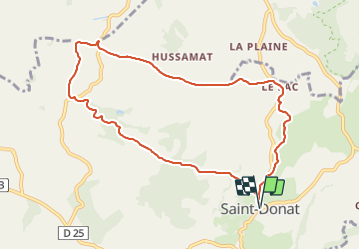
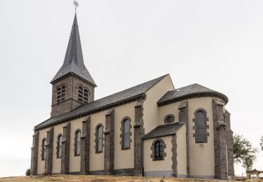
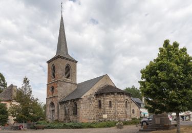
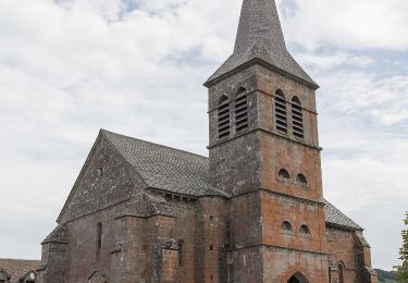
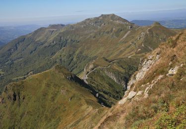
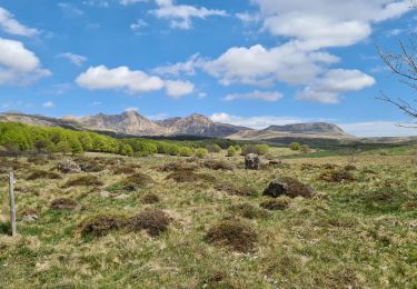
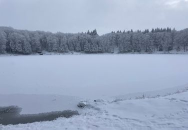
Trail Walking of 9.3 km to be discovered at Auvergne-Rhône-Alpes, Puy-de-Dôme, Saint-Donat. This trail is proposed by jagarnier.

Description

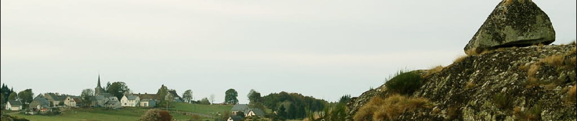
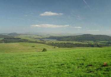
Le plateau de Saint-Donat offre des panoramas sur le Sancy et l’Artense parmi les plus beaux de la région. Les glaciers ont façonné des paysages de landes, fougères et de tourbières. Une curiosité à voir : le rocher en équilibre de «La Roche Juchée».

Elevation profile

Photos

Positioning

Country:
France
Region :
Auvergne-Rhône-Alpes
Department/Province :
Puy-de-Dôme
Municipality :
Saint-Donat
Location:
Unknown
Start:(UTM)
477990 ; 5035111 (31T) N.

Trails nearby

Trail Walking Chastreix - Chastreix. cascades et tourbières  - Photo
Walking
olivier78000

Walking

Easy
(1)
Chastreix, Auvergne-Rhône-Alpes, Puy-de-Dôme, France
13.8 km | 18.3 km-effort
4h 5min
Yes
Trail Mountain bike Picherande - Espace VTT FFC du Sancy - Circuit n°10 - L'Escudor - Secteur Picherande  - Photo
Mountain bike
tracegps

Mountain bike

Difficult
(1)
Picherande, Auvergne-Rhône-Alpes, Puy-de-Dôme, France
14.9 km | 19.8 km-effort
1h 10min
Yes
Trail On foot Saint-Genès-Champespe - Le Lac de la Crégut - Photo
On foot
PRO

On foot

Easy
Saint-Genès-Champespe, Auvergne-Rhône-Alpes, Puy-de-Dôme, France
14 km | 17.7 km-effort
4h 1min
Yes
Trail On foot Saint-Donat - Bertinet - Photo
On foot
PRO

On foot

Easy
Saint-Donat, Auvergne-Rhône-Alpes, Puy-de-Dôme, France
7.9 km | 10 km-effort
2h 15min
Yes
Trail On foot Chastreix - Bois de la Masse - Photo
On foot
PRO

On foot

Easy
Chastreix, Auvergne-Rhône-Alpes, Puy-de-Dôme, France
12.2 km | 16.2 km-effort
3h 40min
Yes
Trail On foot Picherande - La Fontaine Salée - Photo
On foot
PRO

On foot

Medium
Picherande, Auvergne-Rhône-Alpes, Puy-de-Dôme, France
20 km | 29 km-effort
6h 41min
Yes
Trail On foot Chastreix - Chastreix+la réserve_Bois_dela_Masse - Photo
On foot
v.rabot

On foot

Easy
(1)
Chastreix, Auvergne-Rhône-Alpes, Puy-de-Dôme, France
9 km | 12.4 km-effort
2h 48min
Yes
Trail Walking Chastreix - Chastreix - Photo
Walking
v.rabot

Walking

Difficult
Chastreix, Auvergne-Rhône-Alpes, Puy-de-Dôme, France
12.9 km | 16.8 km-effort
3h 49min
Yes
Trail Walking Picherande - Picherande  - Photo
Walking
GUIDE
antignacs

Walking

Very easy
Picherande, Auvergne-Rhône-Alpes, Puy-de-Dôme, France
6.2 km | 7.7 km-effort
2h 4min
Yes


Close
My subscriptions