


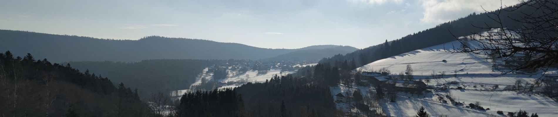
tour de Fréland et d'Aubure

duchaine.nicolas
User
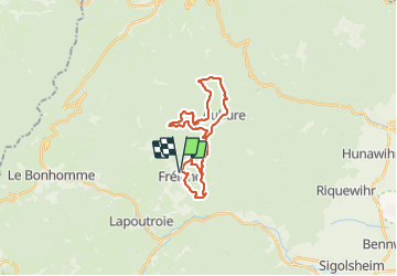

Length
23 km

Max alt
965 m

Uphill gradient
762 m
Km-Effort
34 km

Min alt
448 m

Downhill gradient
759 m
Boucle
Yes
Creation date :
2022-01-16 10:42:02.784
Updated on :
2022-01-30 17:48:36.33
2h29
Difficulty : Easy
2h29
Difficulty : Easy

FREE GPS app for hiking
 SityTrail
IGN / Geographical institutes
SityTrail Plus
The world is yours!
About
Trail Mountain bike of 23 km to be discovered at Grand Est, Haut-Rhin, Fréland. This trail is proposed by duchaine.nicolas.
Photos


Positioning
Country:
France
Region :
Grand Est
Department/Province :
Haut-Rhin
Municipality :
Fréland
Location:
Unknown
Start:(Dec)
Start:(UTM)
365796 ; 5337169 (32U) N.
Comments