


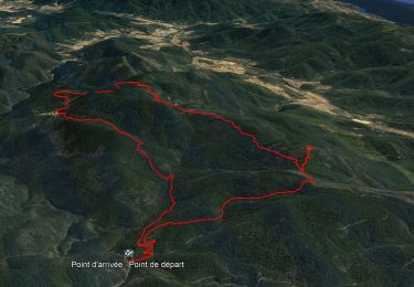
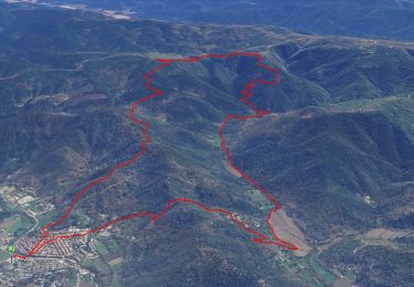
14.4 km | 21 km-effort

User


FREE GPS app for hiking
 SityTrail
IGN / Geographical institutes
SityTrail World
The world is yours!
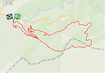
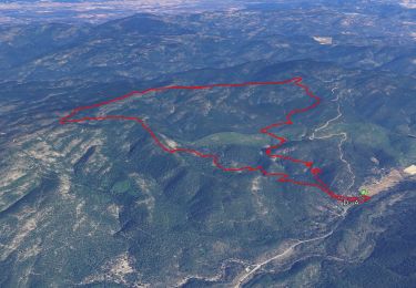
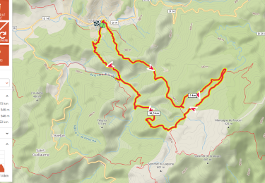
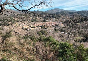
Trail Walking of 14.5 km to be discovered at Provence-Alpes-Côte d'Azur, Var, Collobrières. This trail is proposed by dany83ynad.
Départ parking de Ragusse passage à gué
Montée par piste du barrage, puis du Bousquet pour sommet du Péra. Puis piste des Sivadières au sommet de l'Argentière (belle cabane pour barbecue). Descendre la piste des Sivadières jusqu'à la Chartreuse. Puis monter à gauche pour piste de Ragusse jusqu'à la forêt de cèdres sur chemin à gauche (rambarde à chevaux). Soit reprendre la piste qui serpente jusqu'au bas du vallon du Bousquet soit raccourci direct en descendant la forêt de Cèdres. Prendre le long du ruisseau du Bousquet jusqu'au gué sur la route. Parking à 300m.


Walking
Walking
Walking

Walking

Mountain bike

Walking
Walking
Walking
Walking