


Formigueres/Les Camporells

Machaon6
User
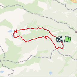

Length
14.8 km

Max alt
2418 m

Uphill gradient
691 m
Km-Effort
24 km

Min alt
1766 m

Downhill gradient
694 m
Boucle
Yes
Creation date :
2018-01-02 00:00:00.0
Updated on :
2018-01-02 00:00:00.0
4h57
Difficulty : Medium

FREE GPS app for hiking
 SityTrail
IGN / Geographical institutes
SityTrail Plus
The world is yours!
About
Trail Walking of 14.8 km to be discovered at Occitania, Pyrénées-Orientales, Formiguères. This trail is proposed by Machaon6.
Description
Rando Stage ARP-FFMM
niveau 2(2013 FORMIGUERES/CAMPORELLS
Photos


Positioning
Country:
France
Region :
Occitania
Department/Province :
Pyrénées-Orientales
Municipality :
Formiguères
Location:
Unknown
Start:(Dec)
Start:(UTM)
423564 ; 4718173 (31T) N.
Comments