Trail Walking Venterol - venterol le mont seigneur - Photo
© OpenStreetMap contributors
Length
Length
18.9 km
Max alt
Max alt
1590 m
Uphill gradient
Uphill gradient
750 m
Km-Effort
Km-Effort  
29 km
Min alt
Min alt
1075 m
Downhill gradient
Downhill gradient
752 m
Boucle
Boucle
Yes
Creation date :
2014-12-10 00:00:00.0
Updated on :
2014-12-10 00:00:00.0

(1 Reviews)

Walking
Walking
6h42
Difficulty : Unknown

Scan this QR Code to open this trail in the SityTrail application

FREE GPS app for hiking

Logo SityTrail SityTrail

IGN / Geographical institutes

Download SityTrail from the App Store Download SityTrail from Google Play

Logo SityTrail SityTrail World

The world is yours!

Download SityTrail from the App Store Download SityTrail from Google Play Download SityTrail on Huawei AppGallery

About

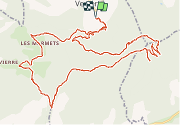
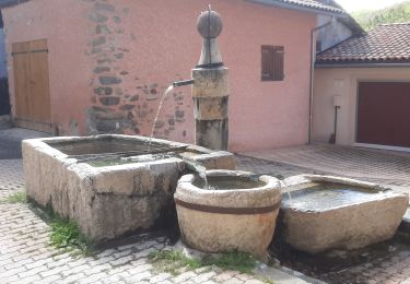
Trail Walking of 18.9 km to be discovered at Provence-Alpes-Côte d'Azur, Alpes-de-Haute-Provence, Venterol. This trail is proposed by Didier.kiehl.

Description


venterol plutôt sympa avec quelques difficultés

Elevation profile

Photos

Points of interest

Point of interest Venterol - Point 1 - Photo
Didier.kiehl
VENTEROL 
Point of interest Gigors - Point 6 - Photo
Didier.kiehl
GIGORS 
Point of interest Gigors - Point 11 - Photo
Didier.kiehl
GIGORS 

Positioning

Country:
France
Region :
Provence-Alpes-Côte d'Azur
Department/Province :
Alpes-de-Haute-Provence
Municipality :
Venterol
Location:
Unknown
Start:(UTM)
269337 ; 4924905 (32T) N.

Comments

Please log in to post a review or rate the element


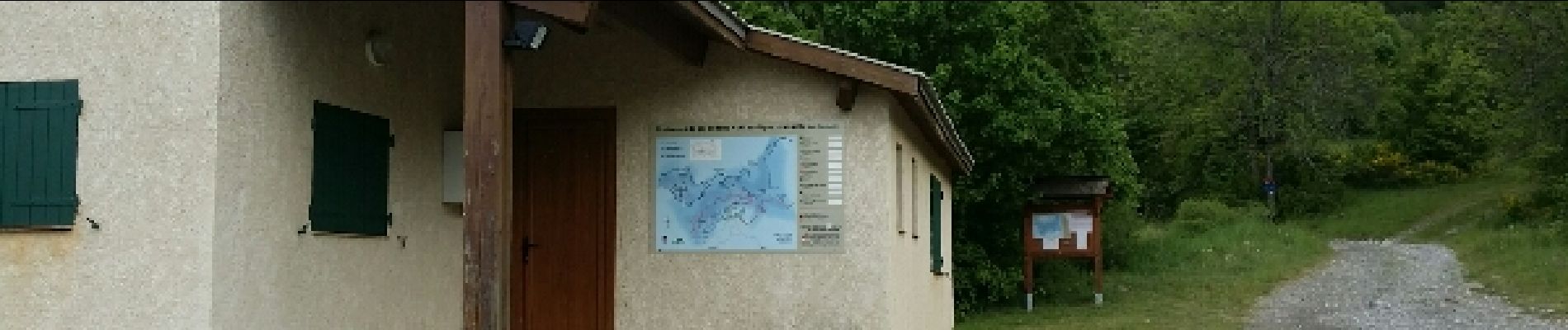
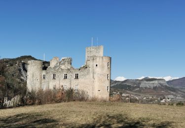
une belle randonnée en forêt avec des point de vue sur les différent sommets de la région : le chaillol, le pic de bure, les falaise de ceuze.


Trails nearby

Trail Walking Turriers - Turriers - Très Pébès - Photo
Walking
GUIDE
R@ph

Walking

Easy
Turriers, Provence-Alpes-Côte d'Azur, Alpes-de-Haute-Provence, France
5 km | 7 km-effort
1h 34min
Yes
Trail Walking Châteauvieux - CHATEAUVIEUX . BOIS DE CHRISTAYES LES MARINONS O S  - Photo
Walking
RobinMicheline

Walking

Medium
Châteauvieux, Provence-Alpes-Côte d'Azur, Hautes-Alpes, France
10.4 km | 14.8 km-effort
3h 7min
Yes
Trail Walking Tallard - Tallard - les Marinons 17.6.23 - Photo
Walking
fredetpascale

Walking

Easy
Tallard, Provence-Alpes-Côte d'Azur, Hautes-Alpes, France
10.2 km | 15.4 km-effort
3h 15min
Yes
Trail Walking Faucon-du-Caire - FAUCON DU CAIRE . LE CLASTRE .  SERRE DE MALAMORT COL DU BUISSONNET O L S - Photo
Walking
RobinMicheline

Walking

Medium
Faucon-du-Caire, Provence-Alpes-Côte d'Azur, Alpes-de-Haute-Provence, France
11.8 km | 21 km-effort
3h 51min
No
Trail Walking Piégut - Tour du ravin de Neyrac Via Piégut - Photo
Walking
PapouBertrand

Walking

Medium
Piégut, Provence-Alpes-Côte d'Azur, Alpes-de-Haute-Provence, France
5.7 km | 11.5 km-effort
2h 10min
Yes
Trail Walking Gigors - GIGORS Cretes des Barses par variante n - Photo
Walking
RobinMicheline

Walking

Difficult
Gigors, Provence-Alpes-Côte d'Azur, Alpes-de-Haute-Provence, France
13.8 km | 24 km-effort
4h 46min
Yes
Trail Walking Tallard - Boucle Tallard - Venterol - Photo
Walking
Daniel.BRUN-PICARD

Walking

Medium
Tallard, Provence-Alpes-Côte d'Azur, Hautes-Alpes, France
8.7 km | 14.9 km-effort
4h 47min
Yes
Trail Walking Tallard - Tour le long de la Durance et sur les crètes du château  - Photo
Walking
Daniel.BRUN-PICARD

Walking

Medium
(1)
Tallard, Provence-Alpes-Côte d'Azur, Hautes-Alpes, France
6.2 km | 8.2 km-effort
2h 26min
Yes
Trail Walking Gigors - GIGORS  2019 - Photo
Walking
BLAIVE

Walking

Difficult
Gigors, Provence-Alpes-Côte d'Azur, Alpes-de-Haute-Provence, France
11.1 km | 21 km-effort
6h 31min
Yes


Close
My subscriptions