


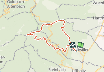
wattwiller

danif
User

Length
15.7 km

Max alt
1091 m

Uphill gradient
833 m
Km-Effort
27 km

Min alt
355 m

Downhill gradient
834 m
Boucle
Yes
Creation date :
2022-01-20 08:20:33.777
Updated on :
2022-01-20 20:20:32.867
8h20
Difficulty : Very difficult

FREE GPS app for hiking
 SityTrail
IGN / Geographical institutes
SityTrail Plus
The world is yours!
About
Trail Walking of 15.7 km to be discovered at Grand Est, Haut-Rhin, Wattwiller. This trail is proposed by danif.
Positioning
Country:
France
Region :
Grand Est
Department/Province :
Haut-Rhin
Municipality :
Wattwiller
Location:
Unknown
Start:(Dec)
Start:(UTM)
363582 ; 5299659 (32T) N.
Comments