Trail Walking Cazenave-Serres-et-Allens - cabane du pla de Tabe - Photo
 chrisgps
chrisgps

User

© OpenStreetMap contributors
Length
Length
9.3 km
Max alt
Max alt
1596 m
Uphill gradient
Uphill gradient
731 m
Km-Effort
Km-Effort  
19 km
Min alt
Min alt
861 m
Downhill gradient
Downhill gradient
734 m
Boucle
Boucle
Yes
Creation date :
2022-01-23 08:01:02.535
Updated on :
2022-01-23 20:29:14.652

(0 Reviews)

Walking
Walking
6h36
Difficulty : Medium

Scan this QR Code to open this trail in the SityTrail application

FREE GPS app for hiking

Logo SityTrail SityTrail

IGN / Geographical institutes

Download SityTrail from the App Store Download SityTrail from Google Play

Logo SityTrail SityTrail World

The world is yours!

Download SityTrail from the App Store Download SityTrail from Google Play Download SityTrail on Huawei AppGallery

About

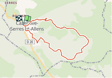
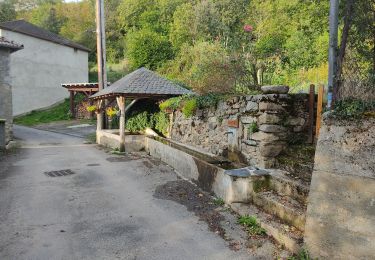
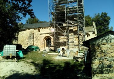
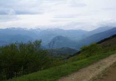
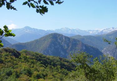
Trail Walking of 9.3 km to be discovered at Occitania, Ariège, Cazenave-Serres-et-Allens. This trail is proposed by chrisgps.

Elevation profile

Photos

Positioning

Country:
France
Region :
Occitania
Department/Province :
Ariège
Municipality :
Cazenave-Serres-et-Allens
Location:
Unknown
Start:(UTM)
391394 ; 4743952 (31T) N.

Trails nearby

Trail Walking Saint-Paul-de-Jarrat - Le Mont Fourcat - Croquié - Photo
Walking
tracegps

Walking

Difficult
(2)
Saint-Paul-de-Jarrat, Occitania, Ariège, France
10.5 km | 20 km-effort
4h 15min
Yes
Trail Running Mercus-Garrabet - mercus1 - Photo
Running
gilbertcaujolle

Running

Very easy
(1)
Mercus-Garrabet, Occitania, Ariège, France
20 km | 37 km-effort
5h 6min
Yes
Trail Walking Mercus-Garrabet - Mont Fourcat en A/R - Photo
Walking
chrisgps

Walking

Easy
Mercus-Garrabet, Occitania, Ariège, France
10 km | 21 km-effort
4h 42min
Yes
Trail On foot Arnave - Le Tour de la Pique - Photo
On foot
PRO

On foot

Easy
Arnave, Occitania, Ariège, France
9.9 km | 17.3 km-effort
3h 55min
Yes
Trail Walking Larnat - Cap de la Lesse - Photo
Walking
c.chehere

Walking

Easy
Larnat, Occitania, Ariège, France
15.5 km | 23 km-effort
5h 41min
Yes
Trail Walking Mercus-Garrabet - Mercus-Garabet - Photo
Walking
c.chehere

Walking

Easy
Mercus-Garrabet, Occitania, Ariège, France
15.5 km | 25 km-effort
7h 45min
No
Trail Walking Larnat - Col de Larnat et Col Doulent - Photo
Walking
c.chehere

Walking

Difficult
(1)
Larnat, Occitania, Ariège, France
14.8 km | 23 km-effort
4h 42min
Yes
Trail Mountain bike Arnave - Mont Fourcat - Arnave - Photo
Mountain bike
tracegps

Mountain bike

Difficult
Arnave, Occitania, Ariège, France
31 km | 52 km-effort
5h 0min
Yes
Trail Walking Arnave - La chapelle Saint-Paul - Arnave  - Photo
Walking
tracegps

Walking

Medium
Arnave, Occitania, Ariège, France
5.2 km | 9.5 km-effort
2h 0min
Yes


Close
My subscriptions