Trail Walking Éply - SC3 Circuit les Prés Bas 4 500m + 39m - Photo

SC3 Circuit les Prés Bas 4 500m + 39m

© OpenStreetMap contributors
Length
Length
4.7 km
Max alt
Max alt
204 m
Uphill gradient
Uphill gradient
40 m
Km-Effort
Km-Effort  
5.3 km
Min alt
Min alt
174 m
Downhill gradient
Downhill gradient
40 m
Boucle
Boucle
Yes
Creation date :
2022-01-26 10:39:27.297
Updated on :
2022-01-29 13:38:59.295

(0 Reviews)

Walking
Walking
1h03
Difficulty : Easy

Scan this QR Code to open this trail in the SityTrail application

FREE GPS app for hiking

Logo SityTrail SityTrail

IGN / Geographical institutes

Download SityTrail from the App Store Download SityTrail from Google Play

Logo SityTrail SityTrail World

The world is yours!

Download SityTrail from the App Store Download SityTrail from Google Play Download SityTrail on Huawei AppGallery

About

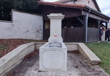
Trail Walking of 4.7 km to be discovered at Grand Est, Meurthe-et-Moselle, Éply. This trail is proposed by DanielROLLET.

Description

Compris AR pour voir le point-de-vue.

Elevation profile

Positioning

Country:
France
Region :
Grand Est
Department/Province :
Meurthe-et-Moselle
Municipality :
Éply
Location:
Unknown
Start:(UTM)
293462 ; 5422272 (32U) N.

Trails nearby

Trail Walking Belleau - Manoncourt sur seille  - Photo
Walking
jean-marie.parachini

Walking

Easy
Belleau, Grand Est, Meurthe-et-Moselle, France
9.5 km | 11.1 km-effort
4h 3min
Yes
Trail Walking Mailly-sur-Seille - Mailly-sur Seille <> Raucourt > Phlin - Photo
Walking
DanielROLLET

Walking

Difficult
Mailly-sur-Seille, Grand Est, Meurthe-et-Moselle, France
13.8 km | 16.2 km-effort
2h 45min
No
Trail Walking Morville-sur-Seille - Morville-sur-Seille, Eply, Raucourt 15 650m +153m - Photo
Walking
DanielROLLET

Walking

Difficult
Morville-sur-Seille, Grand Est, Meurthe-et-Moselle, France
15.6 km | 17.7 km-effort
4h 30min
Yes
Trail Hybrid bike Cheminot - Sort avec lola - Photo
Hybrid bike
meon

Hybrid bike

Easy
Cheminot, Grand Est, Moselle, France
8.6 km | 9.3 km-effort
49min
Yes
Trail Mountain bike Cheminot - Autour de Cheminot  - Photo
Mountain bike
meon

Mountain bike

Very difficult
Cheminot, Grand Est, Moselle, France
44 km | 52 km-effort
3h 29min
No
Trail Walking Mailly-sur-Seille - le Fouyeu - Photo
Walking
DanielROLLET

Walking

Medium
Mailly-sur-Seille, Grand Est, Meurthe-et-Moselle, France
5.1 km | 6.6 km-effort
1h 29min
Yes
Trail Walking Éply - des anciens bois - Photo
Walking
DanielROLLET

Walking

Medium
Éply, Grand Est, Meurthe-et-Moselle, France
7.1 km | 8 km-effort
1h 48min
Yes
Trail Walking Belleau - SL8et SL10 Manoncourt-sur-Seille à Nomeny par Fourasse B - Photo
Walking
DanielROLLET

Walking

Medium
Belleau, Grand Est, Meurthe-et-Moselle, France
5.8 km | 6.3 km-effort
1h 28min
No
Trail Walking Mailly-sur-Seille - le Fouyeu - Photo
Walking
DanielROLLET

Walking

Medium
Mailly-sur-Seille, Grand Est, Meurthe-et-Moselle, France
5.1 km | 6.6 km-effort
1h 29min
Yes


Close
My subscriptions