Trail Walking Gresse-en-Vercors - Pas du Serpaton - Photo
© OpenStreetMap contributors
Length
Length
11 km
Max alt
Max alt
1674 m
Uphill gradient
Uphill gradient
559 m
Km-Effort
Km-Effort  
18.4 km
Min alt
Min alt
1187 m
Downhill gradient
Downhill gradient
544 m
Boucle
Boucle
No
Creation date :
2022-02-03 08:35:36.966
Updated on :
2022-02-03 18:39:35.651

(0 Reviews)

Walking
Walking
5h41
Difficulty : Medium

Scan this QR Code to open this trail in the SityTrail application

FREE GPS app for hiking

Logo SityTrail SityTrail

IGN / Geographical institutes

Download SityTrail from the App Store Download SityTrail from Google Play

Logo SityTrail SityTrail World

The world is yours!

Download SityTrail from the App Store Download SityTrail from Google Play Download SityTrail on Huawei AppGallery

About

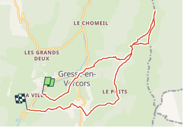
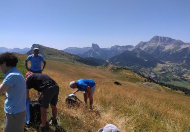
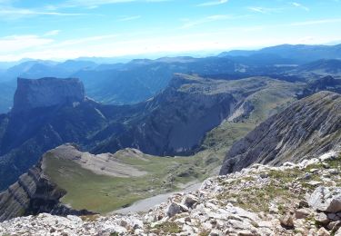
Trail Walking of 11 km to be discovered at Auvergne-Rhône-Alpes, Isère, Gresse-en-Vercors. This trail is proposed by GuyVachet.

Description

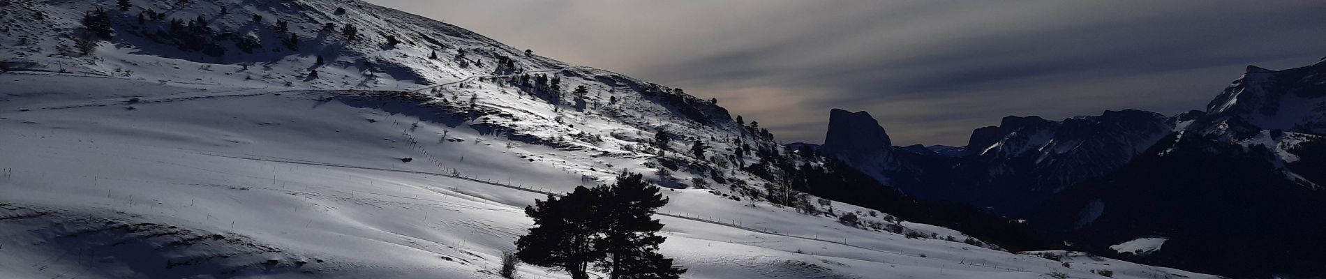
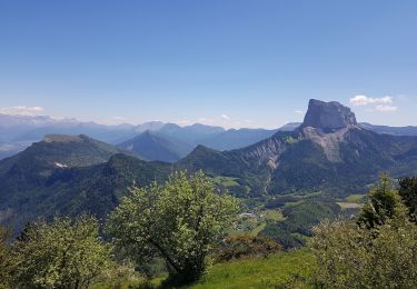
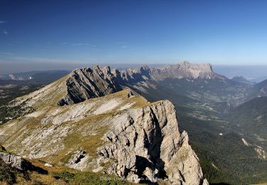
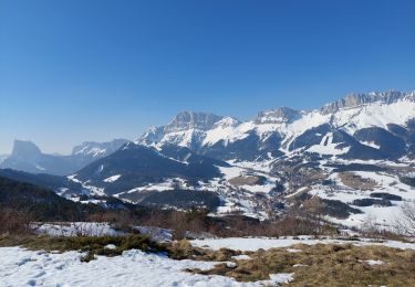
Boucle en raquettes pour le Pas du Serpaton à partir des parkings de la zone nordique. Cet itinéraire est placé sous le signe du Mont-Aiguille. Après une montée soutenue, le belvédère un peu avant le pas, offre une vue panoramique sur le Vercors avec notamment le Grand Veymont puis à la Croix de Gresse, c'est au tour du Dévoluy, des Écrins et de Belledonne. Il est intéressant de continuer sur les Crêtes jusqu'à la côte 1686 pour compléter la vue sur la barrière orientale du Vercors  rehaussée par la neige sans oublier la Chartreuse. La descente tranquille par Uclaire permet de terminer la journée en continuant à admirer le Mont-Aiguille.

Elevation profile

Photos

Positioning

Country:
France
Region :
Auvergne-Rhône-Alpes
Department/Province :
Isère
Municipality :
Gresse-en-Vercors
Location:
Unknown
Start:(UTM)
701699 ; 4974752 (31T) N.

Trails nearby

Trail Walking Gresse-en-Vercors - Quinquambaye - crête du Brisou - Photo
Walking
patjobou

Walking

Medium
(1)
Gresse-en-Vercors, Auvergne-Rhône-Alpes, Isère, France
12.1 km | 23 km-effort
6h 28min
Yes
Trail Walking Gresse-en-Vercors - Traversée du Rocher du Baconnet - Photo
Walking
tracegps

Walking

Easy
(2)
Gresse-en-Vercors, Auvergne-Rhône-Alpes, Isère, France
10.7 km | 18.9 km-effort
5h 0min
Yes
Trail Walking Gresse-en-Vercors - le grand veymont  depuis gresse en vercors et par le pas de la ville - Photo
Walking
aztec

Walking

Medium
(1)
Gresse-en-Vercors, Auvergne-Rhône-Alpes, Isère, France
10.9 km | 25 km-effort
4h 53min
Yes
Trail Walking Gresse-en-Vercors - Le grand veymont 2341 m - Photo
Walking
Youcef Atallah

Walking

Very difficult
Gresse-en-Vercors, Auvergne-Rhône-Alpes, Isère, France
18 km | 38 km-effort
4h 18min
Yes
Trail Walking Gresse-en-Vercors - Roche Rousse - Photo
Walking
flip38

Walking

Difficult
Gresse-en-Vercors, Auvergne-Rhône-Alpes, Isère, France
11.9 km | 25 km-effort
4h 52min
Yes
Trail Walking Saint-Guillaume - Rando de la Montagne de la Pâle - Photo
Walking
Titus50

Walking

Difficult
Saint-Guillaume, Auvergne-Rhône-Alpes, Isère, France
15.5 km | 28 km-effort
5h 24min
Yes
Trail Walking Gresse-en-Vercors -  Pas des Baschassons - Carrière romaine - Pas de la Selle - Photo
Walking
ilur56

Walking

Difficult
Gresse-en-Vercors, Auvergne-Rhône-Alpes, Isère, France
16.9 km | 31 km-effort
7h 0min
Yes
Trail Snowshoes Gresse-en-Vercors - Gresse en Vercors :pas du Serpaton-Rocher du Baconnet-Uclaire-pas du Bru - Photo
Snowshoes
Valgaudemar

Snowshoes

Medium
Gresse-en-Vercors, Auvergne-Rhône-Alpes, Isère, France
10.4 km | 18.2 km-effort
3h 36min
Yes
Trail Walking Gresse-en-Vercors - Le Grand Veymont en circuit partiel - Photo
Walking
Emelle

Walking

Difficult
Gresse-en-Vercors, Auvergne-Rhône-Alpes, Isère, France
13.6 km | 28 km-effort
30h 41min
Yes


Close
My subscriptions