


G3Aramits fait2022

LouisROGER
User GUIDE
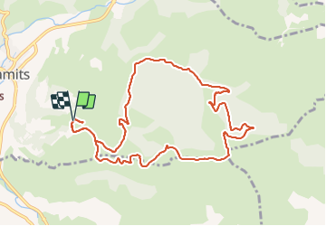

Length
11.3 km

Max alt
551 m

Uphill gradient
356 m
Km-Effort
16.1 km

Min alt
277 m

Downhill gradient
361 m
Boucle
Yes
Creation date :
2022-02-04 08:43:24.818
Updated on :
2022-02-04 13:56:10.467
3h14
Difficulty : Difficult

FREE GPS app for hiking
 SityTrail
IGN / Geographical institutes
SityTrail Plus
The world is yours!
About
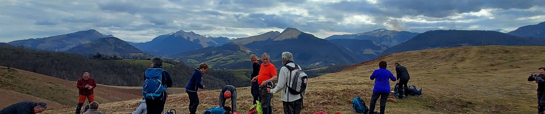
Trail Walking of 11.3 km to be discovered at New Aquitaine, Pyrénées-Atlantiques, Aramits. This trail is proposed by LouisROGER.
Photos


Positioning
Country:
France
Region :
New Aquitaine
Department/Province :
Pyrénées-Atlantiques
Municipality :
Aramits
Location:
Unknown
Start:(Dec)
Start:(UTM)
685886 ; 4776020 (30T) N.
Comments