


col de la Lavoire

laurentnecca
User
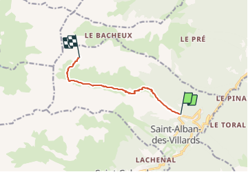

Length
7.4 km

Max alt
2398 m

Uphill gradient
1323 m
Km-Effort
21 km

Min alt
1065 m

Downhill gradient
1 m
Boucle
No
Creation date :
2022-02-09 06:33:20.828
Updated on :
2022-02-09 10:09:32.121
3h36
Difficulty : Difficult

FREE GPS app for hiking
 SityTrail
IGN / Geographical institutes
SityTrail Plus
The world is yours!
About
Trail Touring skiing of 7.4 km to be discovered at Auvergne-Rhône-Alpes, Savoy, Saint-Alban-des-Villards. This trail is proposed by laurentnecca.
Positioning
Country:
France
Region :
Auvergne-Rhône-Alpes
Department/Province :
Savoy
Municipality :
Saint-Alban-des-Villards
Location:
Unknown
Start:(Dec)
Start:(UTM)
284538 ; 5021773 (32T) N.
Comments