


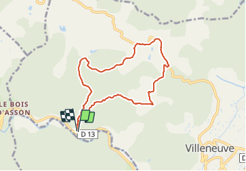

16.2 km | 24 km-effort


User


FREE GPS app for hiking
 SityTrail
IGN / Geographical institutes
SityTrail World
The world is yours!
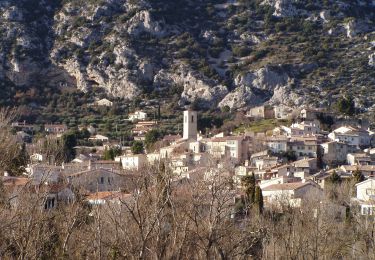
Trail Walking of 7.9 km to be discovered at Provence-Alpes-Côte d'Azur, Alpes-de-Haute-Provence, Villeneuve. This trail is proposed by liocol.
Garez vous, avant le bois d'Asson, en face du Radar. départ de la rando, barrière verte et balisage jaune.


Mountain bike
Trail
Walking
Walking
On foot
Walking
Walking

Walking
Walking