


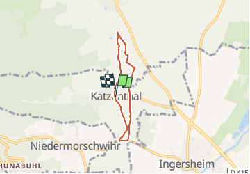
Katzenthal

jcschubnel
User

Length
4.6 km

Max alt
282 m

Uphill gradient
77 m
Km-Effort
5.7 km

Min alt
240 m

Downhill gradient
79 m
Boucle
Yes
Creation date :
2022-02-08 13:24:56.816
Updated on :
2022-02-09 13:00:16.99
1h14
Difficulty : Easy

FREE GPS app for hiking
 SityTrail
IGN / Geographical institutes
SityTrail Plus
The world is yours!
About
Trail Walking of 4.6 km to be discovered at Grand Est, Haut-Rhin, Katzenthal. This trail is proposed by jcschubnel.
Positioning
Country:
France
Region :
Grand Est
Department/Province :
Haut-Rhin
Municipality :
Katzenthal
Location:
Unknown
Start:(Dec)
Start:(UTM)
372309 ; 5329721 (32U) N.
Comments