![](/images/other/stat-length.png)
![Trail On foot Kehlen - Autopédestre Nospelt 1 - Photo](https://media.geolcdn.com/t/1900/400/ext.pjpeg?maxdim=2&url=https%3A%2F%2Fmedia.geolcdn.com%2Ff%2F282ba8aa-0434-4ce2-9b9d-7b0153c4ba8f.jpeg)
Autopédestre Nospelt 1
SityTrail - itinéraires balisés pédestres
Tous les sentiers balisés d’Europe PRO
![Length](/images/other/stat-length.png)
Length
7.6 km
![Max alt](https://static1.geolcdn.com/siteimages/upload/files/1508320355ic_sort_altitude_max_24dp.png)
Max alt
375 m
![Uphill gradient](https://static1.geolcdn.com/siteimages/upload/files/1508320355ic_sort_den_pos_24dp.png)
Uphill gradient
128 m
![Km-Effort](/images/other/stat-length.png)
Km-Effort
9.3 km
![Min alt](https://static1.geolcdn.com/siteimages/upload/files/1508320355ic_sort_altitude_min_24dp.png)
Min alt
300 m
![Downhill gradient](https://static1.geolcdn.com/siteimages/upload/files/1508320355ic_sort_den_neg_24dp.png)
Downhill gradient
129 m
![Boucle](https://static1.geolcdn.com/siteimages/upload/files/16400158638029165_repeat_loop_refresh_sync_direction_icon.png)
Boucle
Yes
Signpost
Creation date :
2022-02-09 15:31:56.58
Updated on :
2022-02-09 18:08:23.53
![On foot](https://static1.geolcdn.com/sitytour/trail-icons/100.png)
2h06
Difficulty : Easy
![Scan this QR Code to open this trail in the SityTrail application](https://capi.geolives.com/qq0zvz2zws4bq2lad0pu/sitytour/trails/3083730/qr.png?size=200)
FREE GPS app for hiking
About
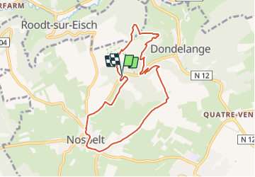
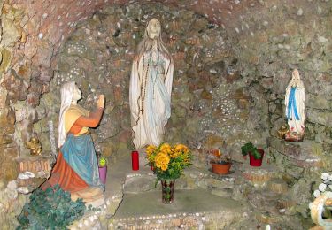
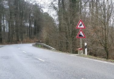
Trail On foot of 7.6 km to be discovered at Unknown, Canton Capellen, Kehlen. This trail is proposed by SityTrail - itinéraires balisés pédestres.
Description
Trail created by Ministère des Classes moyennes et du Tourisme.
Symbol: Blue Pointer
Positioning
Country:
Luxembourg
Region :
Unknown
Department/Province :
Canton Capellen
Municipality :
Kehlen
Location:
Nospelt
Start:(Dec)
Start:(UTM)
284821 ; 5507810 (32U) N.
Comments
Trails nearby
![Trail Walking Helperknapp - Itinérant Luxembourg Jour 2- Luxembourg La Rochette - Photo](https://media.geolcdn.com/t/375/260/ext.jpg?maxdim=2&url=https%3A%2F%2Fmedia.geolcdn.com%2Ff%2F06c6e940-078a-4953-b7df-8d3a15a505cf.jpg)
![Walking Walking](https://static1.geolcdn.com/sitytour/trail-icons/101.png)
Itinérant Luxembourg Jour 2- Luxembourg La Rochette
Walking
Very difficult
Helperknapp,
Unknown,
Canton Mersch,
Luxembourg
![](/images/other/stat-length.png)
30 km | 40 km-effort
6h 44min
![](https://static1.geolcdn.com/siteimages/upload/files/16400158638029165_repeat_loop_refresh_sync_direction_icon.png)
No
![Trail On foot Mamer - Engelsratt - Photo](https://media.geolcdn.com/t/375/260/ext.jpg?maxdim=2&url=https%3A%2F%2Fmedia.geolcdn.com%2Ff%2F98ed393c-e165-49aa-9823-ca410d94c4f3.jpeg)
![On foot On foot](https://static1.geolcdn.com/sitytour/trail-icons/100.png)
Engelsratt
On foot
Easy
Mamer,
Unknown,
Canton Capellen,
Luxembourg
![](/images/other/stat-length.png)
5.5 km | 6.7 km-effort
1h 30min
![](https://static1.geolcdn.com/siteimages/upload/files/16400158638029165_repeat_loop_refresh_sync_direction_icon.png)
No
![Trail On foot Mamer - Jongebësch - Photo](https://media.geolcdn.com/t/375/260/ext.jpg?maxdim=2&url=https%3A%2F%2Fmedia.geolcdn.com%2Ff%2F8d560f66-912d-4908-a3f0-70095c4e11f9.jpeg)
![On foot On foot](https://static1.geolcdn.com/sitytour/trail-icons/100.png)
Jongebësch
On foot
Easy
Mamer,
Unknown,
Canton Capellen,
Luxembourg
![](/images/other/stat-length.png)
6.3 km | 7.2 km-effort
1h 37min
![](https://static1.geolcdn.com/siteimages/upload/files/16400158638029165_repeat_loop_refresh_sync_direction_icon.png)
Yes
![Trail On foot Kehlen - Autopédestre Nospelt II - Photo](https://media.geolcdn.com/t/375/260/ext.jpg?maxdim=2&url=https%3A%2F%2Fmedia.geolcdn.com%2Ff%2F8d3da152-f769-4ac4-b329-3fe29861c9b2.jpeg)
![On foot On foot](https://static1.geolcdn.com/sitytour/trail-icons/100.png)
Autopédestre Nospelt II
On foot
Easy
Kehlen,
Unknown,
Canton Capellen,
Luxembourg
![](/images/other/stat-length.png)
6 km | 7.9 km-effort
1h 47min
![](https://static1.geolcdn.com/siteimages/upload/files/16400158638029165_repeat_loop_refresh_sync_direction_icon.png)
Yes
![Trail On foot Kehlen - Promenade Historique Kehlen - Photo](https://media.geolcdn.com/t/375/260/ext.jpg?maxdim=2&url=https%3A%2F%2Fmedia.geolcdn.com%2Ff%2F0dd16777-9f19-440a-b942-94e784d01062.jpeg)
![On foot On foot](https://static1.geolcdn.com/sitytour/trail-icons/100.png)
Promenade Historique Kehlen
On foot
Easy
Kehlen,
Unknown,
Canton Capellen,
Luxembourg
![](/images/other/stat-length.png)
7.7 km | 9.3 km-effort
2h 6min
![](https://static1.geolcdn.com/siteimages/upload/files/16400158638029165_repeat_loop_refresh_sync_direction_icon.png)
Yes
![Trail On foot Saeul - Cross Track - Photo](https://media.geolcdn.com/t/375/260/ext.jpg?maxdim=2&url=https%3A%2F%2Fmedia.geolcdn.com%2Ff%2F103c0040-1c40-4ce9-b472-dbb23cf04b90.jpeg)
![On foot On foot](https://static1.geolcdn.com/sitytour/trail-icons/100.png)
Cross Track
On foot
Easy
Saeul,
Unknown,
Canton Redange,
Luxembourg
![](/images/other/stat-length.png)
6.6 km | 8.9 km-effort
2h 1min
![](https://static1.geolcdn.com/siteimages/upload/files/16400158638029165_repeat_loop_refresh_sync_direction_icon.png)
No
![Trail On foot Saeul - Flech Bleu Saeul - Photo](https://media.geolcdn.com/t/375/260/ext.jpg?maxdim=2&url=https%3A%2F%2Fmedia.geolcdn.com%2Ff%2F103c0040-1c40-4ce9-b472-dbb23cf04b90.jpeg)
![On foot On foot](https://static1.geolcdn.com/sitytour/trail-icons/100.png)
Flech Bleu Saeul
On foot
Easy
Saeul,
Unknown,
Canton Redange,
Luxembourg
![](/images/other/stat-length.png)
8.6 km | 11.2 km-effort
2h 32min
![](https://static1.geolcdn.com/siteimages/upload/files/16400158638029165_repeat_loop_refresh_sync_direction_icon.png)
Yes
![Trail On foot Helperknapp - FB Hollenfels - Photo](https://media.geolcdn.com/t/375/260/ext.jpg?maxdim=2&url=https%3A%2F%2Fmedia.geolcdn.com%2Ff%2Fef21ca21-f2a4-4c91-afb7-648dd3fcd3a9.jpeg)
![On foot On foot](https://static1.geolcdn.com/sitytour/trail-icons/100.png)
FB Hollenfels
On foot
Easy
Helperknapp,
Unknown,
Canton Mersch,
Luxembourg
![](/images/other/stat-length.png)
8.5 km | 10.9 km-effort
2h 28min
![](https://static1.geolcdn.com/siteimages/upload/files/16400158638029165_repeat_loop_refresh_sync_direction_icon.png)
Yes
![Trail On foot Helperknapp - Auto Pedestre Tuntange - Photo](https://media.geolcdn.com/t/375/260/ext.jpg?maxdim=2&url=https%3A%2F%2Fmedia.geolcdn.com%2Ff%2F3811bba0-eb0b-4754-bfe1-048a09110d1c.jpeg)
![On foot On foot](https://static1.geolcdn.com/sitytour/trail-icons/100.png)
Auto Pedestre Tuntange
On foot
Easy
Helperknapp,
Unknown,
Canton Mersch,
Luxembourg
![](/images/other/stat-length.png)
5.1 km | 6.8 km-effort
1h 32min
![](https://static1.geolcdn.com/siteimages/upload/files/16400158638029165_repeat_loop_refresh_sync_direction_icon.png)
Yes