


Clara-Liasseras(village en ruine)

Machaon6
User
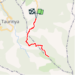

Length
7.9 km

Max alt
1350 m

Uphill gradient
773 m
Km-Effort
18.2 km

Min alt
566 m

Downhill gradient
772 m
Boucle
Yes
Creation date :
2014-12-10 00:00:00.0
Updated on :
2014-12-10 00:00:00.0
3h31
Difficulty : Medium

FREE GPS app for hiking
 SityTrail
IGN / Geographical institutes
SityTrail Plus
The world is yours!
About
Trail Walking of 7.9 km to be discovered at Occitania, Pyrénées-Orientales, Clara-Villerach. This trail is proposed by Machaon6.
Positioning
Country:
France
Region :
Occitania
Department/Province :
Pyrénées-Orientales
Municipality :
Clara-Villerach
Location:
Unknown
Start:(Dec)
Start:(UTM)
454232 ; 4714572 (31T) N.
Comments