


Py-Cantapoc(A-R)

Machaon6
User
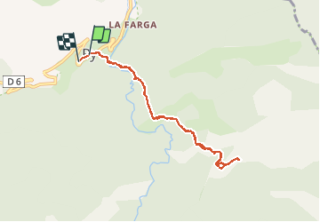

Length
9.1 km

Max alt
1451 m

Uphill gradient
560 m
Km-Effort
16.5 km

Min alt
981 m

Downhill gradient
542 m
Boucle
Yes
Creation date :
2016-04-25 00:00:00.0
Updated on :
2016-04-25 00:00:00.0
3h29
Difficulty : Difficult

FREE GPS app for hiking
 SityTrail
IGN / Geographical institutes
SityTrail Plus
The world is yours!
About
Trail Walking of 9.1 km to be discovered at Occitania, Pyrénées-Orientales, Py. This trail is proposed by Machaon6.
Photos
 - Photo 1")
 - Photo 2")


Positioning
Country:
France
Region :
Occitania
Department/Province :
Pyrénées-Orientales
Municipality :
Py
Location:
Unknown
Start:(Dec)
Start:(UTM)
446652 ; 4705007 (31T) N.
Comments