Py-Cantapoc(circuit)

Machaon6
User
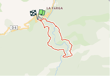

Length
6.7 km

Max alt
1309 m

Uphill gradient
405 m
Km-Effort
12.1 km

Min alt
984 m

Downhill gradient
403 m
Boucle
Yes
Creation date :
2018-01-11 00:00:00.0
Updated on :
2018-01-11 00:00:00.0
2h45
Difficulty : Difficult

FREE GPS app for hiking
 SityTrail
IGN / Geographical institutes
SityTrail Plus
The world is yours!
About
Trail Walking of 6.7 km to be discovered at Occitania, Pyrénées-Orientales, Py. This trail is proposed by Machaon6.
Description
Le passage de la rivière de la Rotja se fait par un tronc d'arbre.....FAIRE ATTENTION!


Positioning
Country:
France
Region :
Occitania
Department/Province :
Pyrénées-Orientales
Municipality :
Py
Location:
Unknown
Start:(Dec)
Start:(UTM)
446555 ; 4704947 (31T) N.
Comments