


Ile de Ré-La Flotte Rivedoux

Bobol
User
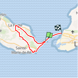

Length
21 km

Max alt
23 m

Uphill gradient
110 m
Km-Effort
23 km

Min alt
-1 m

Downhill gradient
110 m
Boucle
No
Creation date :
2016-03-09 00:00:00.0
Updated on :
2016-03-09 00:00:00.0
4h24
Difficulty : Easy

FREE GPS app for hiking
 SityTrail
IGN / Geographical institutes
SityTrail Plus
The world is yours!
About
Trail Walking of 21 km to be discovered at New Aquitaine, Charente-Maritime, Rivedoux-Plage. This trail is proposed by Bobol.
Description
Pour cette randonnée nous avons pris la navette électrique du parking du Belvédère à Rivedoux (1€/personne) et retour par le pont.
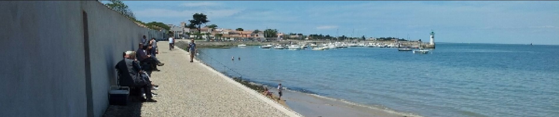
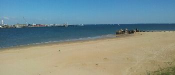
Photos


Positioning
Country:
France
Region :
New Aquitaine
Department/Province :
Charente-Maritime
Municipality :
Rivedoux-Plage
Location:
Unknown
Start:(Dec)
Start:(UTM)
634535 ; 5113560 (30T) N.
Comments