Trail Walking Valjouffrey - Valbonnais Refuges Font Turbat - Photo

Valbonnais Refuges Font Turbat

 Orcal37
Orcal37

User

© OpenStreetMap contributors
Length
Length
22 km
Max alt
Max alt
2178 m
Uphill gradient
Uphill gradient
954 m
Km-Effort
Km-Effort  
34 km
Min alt
Min alt
1244 m
Downhill gradient
Downhill gradient
953 m
Boucle
Boucle
Yes
Creation date :
2014-12-10 00:00:00.0
Updated on :
2021-09-21 18:45:10.513

(0 Reviews)

Walking
Walking
6h15
Difficulty : Difficult

Scan this QR Code to open this trail in the SityTrail application

FREE GPS app for hiking

Logo SityTrail SityTrail

IGN / Geographical institutes

Download SityTrail from the App Store Download SityTrail from Google Play

Logo SityTrail SityTrail World

The world is yours!

Download SityTrail from the App Store Download SityTrail from Google Play Download SityTrail on Huawei AppGallery

About

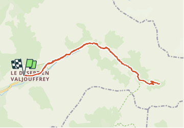
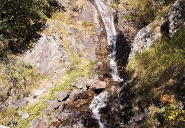
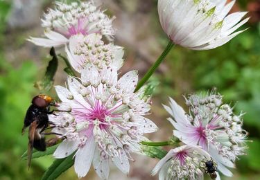
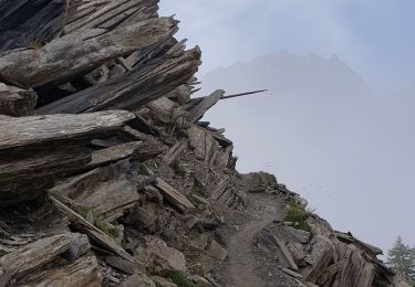
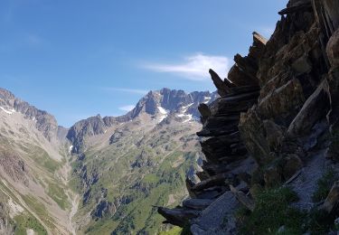
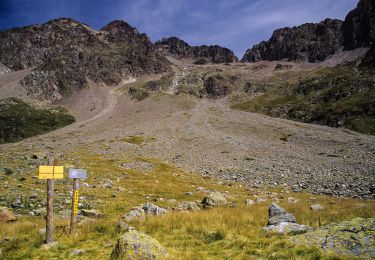
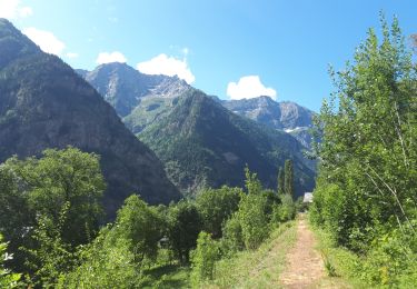
Trail Walking of 22 km to be discovered at Auvergne-Rhône-Alpes, Isère, Valjouffrey. This trail is proposed by Orcal37.

Description

Valbonnais - Le Désert en Valjouffrey - Refuges de Font Turbat

Elevation profile

Photos

Positioning

Country:
France
Region :
Auvergne-Rhône-Alpes
Department/Province :
Isère
Municipality :
Valjouffrey
Location:
Unknown
Start:(UTM)
269892 ; 4972527 (32T) N.

Trails nearby

Trail Walking Valjouffrey - Valbonnais-Valsenestre Combe Guyon Lac Labarre Chemin de la Martine - Photo
Walking
Maryma

Walking

Very difficult
(1)
Valjouffrey, Auvergne-Rhône-Alpes, Isère, France
16 km | 34 km-effort
7h 42min
Yes
Trail Walking Villar-Loubière - Valgo2 - J1 : Col des Clochettes - Photo
Walking
ETMU5496

Walking

Difficult
Villar-Loubière, Provence-Alpes-Côte d'Azur, Hautes-Alpes, France
14.6 km | 30 km-effort
4h 12min
Yes
Trail Walking Villar-Loubière - Cime de Turbat.  - Photo
Walking
Dervalmarc

Walking

Difficult
Villar-Loubière, Provence-Alpes-Côte d'Azur, Hautes-Alpes, France
15.1 km | 32 km-effort
7h 31min
No
Trail Walking Villar-Loubière - Refuge des souffles.  - Photo
Walking
Dervalmarc

Walking

Medium
Villar-Loubière, Provence-Alpes-Côte d'Azur, Hautes-Alpes, France
4.5 km | 13.7 km-effort
2h 1min
No
Trail Walking Valjouffrey - 38  Valjoufrey Les Faures à Malentraz - Photo
Walking
chris13370

Walking

Medium
Valjouffrey, Auvergne-Rhône-Alpes, Isère, France
11.9 km | 23 km-effort
5h 0min
Yes
Trail Walking Valjouffrey - 38 Valsenestre au col de Côte Belle - Photo
Walking
chris13370

Walking

Medium
Valjouffrey, Auvergne-Rhône-Alpes, Isère, France
13.6 km | 27 km-effort
5h 30min
Yes
Trail Walking Valjouffrey - Cote Belle et les Orgues du Valsenestre - Photo
Walking
patjobou

Walking

Difficult
Valjouffrey, Auvergne-Rhône-Alpes, Isère, France
15 km | 31 km-effort
7h 46min
Yes
Trail Walking Villar-Loubière - J2 Valgo - Photo
Walking
ETMU5496

Walking

Difficult
Villar-Loubière, Provence-Alpes-Côte d'Azur, Hautes-Alpes, France
15.3 km | 30 km-effort
Unknown
No
Trail Mountain bike Villar-Loubière - vtt 6 valgaudemar - Photo
Mountain bike
dadodeca

Mountain bike

Difficult
Villar-Loubière, Provence-Alpes-Côte d'Azur, Hautes-Alpes, France
20 km | 27 km-effort
2h 42min
Yes


Close
My subscriptions