Trail On foot Laxe - O Camiño dos Faros: Etapa 4 (Laxe-Arou) - Photo

O Camiño dos Faros: Etapa 4 (Laxe-Arou)

Tous les sentiers balisés d’Europe PRO

© OpenStreetMap contributors
Length
Length
8.5 km
Max alt
Max alt
75 m
Uphill gradient
Uphill gradient
232 m
Km-Effort
Km-Effort  
11.6 km
Min alt
Min alt
0 m
Downhill gradient
Downhill gradient
234 m
Boucle
Boucle
No
Signpost
Signpost
Creation date :
2022-02-14 15:54:03.962
Updated on :
2022-02-14 15:54:03.962

(0 Reviews)

On foot
On foot
2h37
Difficulty : Easy

Scan this QR Code to open this trail in the SityTrail application

FREE GPS app for hiking

Logo SityTrail SityTrail

IGN / Geographical institutes

Download SityTrail from the App Store Download SityTrail from Google Play

Logo SityTrail SityTrail World

The world is yours!

Download SityTrail from the App Store Download SityTrail from Google Play Download SityTrail on Huawei AppGallery

About

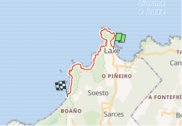
Trail On foot of 8.5 km to be discovered at Galicia, A Coruña, Laxe. This trail is proposed by SityTrail - itinéraires balisés pédestres.

Description

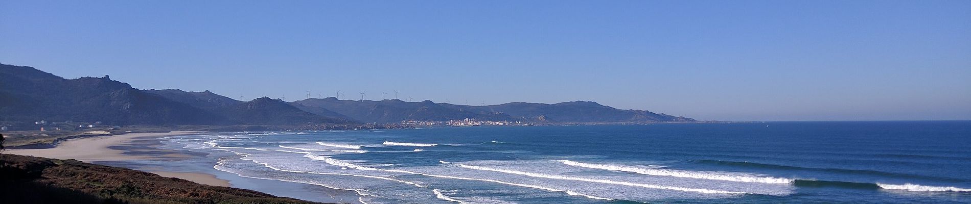
O Camiño dos Faros es una ruta de senderismo de 200 kilómetros que une Malpica con Finisterre por el borde del mar en A Costa da Morte (Galicia-España)

Website: http://www.caminodosfaros.com

Photos

Positioning

Country:
Spain
Region :
Galicia
Department/Province :
A Coruña
Municipality :
Laxe
Location:
Laxe
Start:(UTM)
499594 ; 4785526 (29T) N.

Trails nearby

Trail On foot Laxe - Laxe-Traba - Photo
On foot
PRO

On foot

Easy
Laxe, Galicia, A Coruña, Spain
3.4 km | 4 km-effort
55min
No
Trail On foot Ponteceso - O Camiño dos Faros: Etapa 2 (Niñóns-Ponteceso) - Photo
On foot
PRO

On foot

Easy
Ponteceso, Galicia, A Coruña, Spain
9.2 km | 11.9 km-effort
2h 41min
No


Close
My subscriptions