


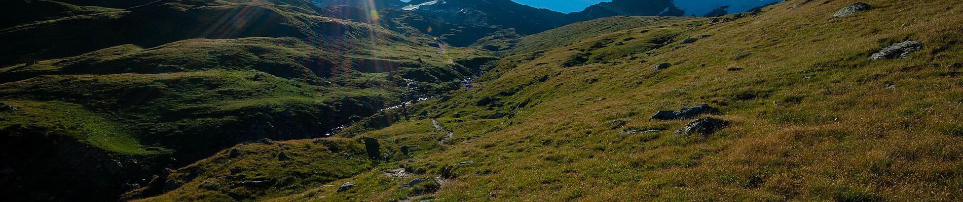
11, Rif. Bezzi - Rif. Chalet de l'Epée

SityTrail - itinéraires balisés pédestres
Tous les sentiers balisés d’Europe GUIDE+
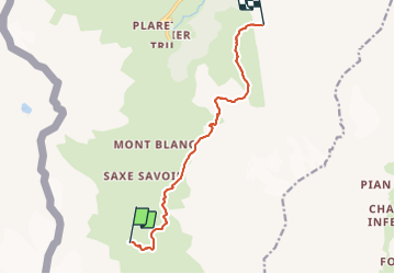

Length
9.7 km

Max alt
2657 m

Uphill gradient
670 m
Km-Effort
18.4 km

Min alt
2277 m

Downhill gradient
588 m
Boucle
No

Signpost
Creation date :
2022-02-15 02:41:19.407
Updated on :
2022-02-28 23:31:20.832
4h10
Difficulty : Easy

FREE GPS app for hiking
 SityTrail
IGN / Geographical institutes
SityTrail Plus
The world is yours!
About
Trail On foot of 9.7 km to be discovered at Aosta Valley, Unknown, Valgrisenche. This trail is proposed by SityTrail - itinéraires balisés pédestres.
Photos


Positioning
Country:
Italy
Region :
Aosta Valley
Department/Province :
Unknown
Municipality :
Valgrisenche
Location:
Unknown
Start:(Dec)
Start:(UTM)
345269 ; 5044927 (32T) N.
Comments